REMOTE HUTS
  • HUTS
    • A-Z
    • By River Catchment
    • By Map
  • TRACKS
  • ABOUT US
  • JARGON
  • LINKS
  • CONTACT
  • Donations
  • HUTS
    • A-Z
    • By River Catchment
    • By Map
  • TRACKS
  • ABOUT US
  • JARGON
  • LINKS
  • CONTACT
  • Donations
Picture
  • Adventure Biv
  • Bluff Hut
  • Boo Boo Hut
  • Browning Biv
  • Burn Creek Hut
  • Campbell Biv
  • Cone Creek Hut
  • County Stream Hut
  • Crawford Junction Hut
  • Crystal Biv
  • Dickie Spur Hut
  • Dunns Hut
  • Explorer Hut
  • Frisco Hut
  • Frew Saddle Biv
  • Gerhardt Spur Biv
  • Greys Hut
  • Griffin Creek Hut
  • Healey Creek Hut
  • Hunts Creek Hut
  • Ivory Lake Hut
  • Jacko Flat Hut
  • Johnson Hut
  • Kakapo Hut
  • Kiwi Flat Hut
  • Kiwi Hut (Taramakau)
  • Koropuku Hut
  • Lake Morgan Hut
  • Lower Olderog Biv
  • Mid Styx Hut
  • Mid Trent Hut
  • Mikonui Spur Biv
  • Moonbeam Hut
  • Mt Brown Hut
  • Mt Curtis Hut
  • Mullins Hut
  • Mungo Hut
  • ​Newton Creek Hut


  • ​Newton Range Biv
  • Nardoo Biv
  • Nolans Hut
  • Old Julia Hut
  • Otehake Hut
  • Pell Stream Hut
  • Pfeifer Biv
  • Pinnacle Biv
  • Poet Hut
  • Polluck Creek Hut
  • Price Basin Hut
  • Roaring Billy Hut
  • Rocky Creek Biv
  • Scamper Torrent Hut
  • Scottys Biv
  • Serpentine Hut
  • Sir Robert Hut
  • Smyth Hut
  • Stan's Hut
  • Thomas River Hut
  • Toaroha Saddle Biv
  • Top Crawford Hut
  • Top Crooked Hut
  • Top Kokatahi Hut
  • Top Okarito Hut
  • Top Olderog Biv
  • Top Trent (Lagoon) Hut
  • Top Tuke Hut
  • Top Waitaha Hut
  • Top Waitahu Biv
  • Townsend Hut
  • Tunnel Creek Hut
  • Waikiti Hut
  • Wheel Creek Hut
  • Wilkinson Hut
  • Yeats Ridge Hut
  • Archive of Huts lost and gone.

​Locating the Huts Geographically
  • Each of the hut pages on the website has a small map, which if clicked takes you to the relevant location on the www.topomap.co.nz website

Permolat Tracks not found on NZ Topo Map website
  • Some of the tracks being maintained by Permolat are not marked on the NZ Topo maps, either hard copy, or online. If you email us we can send you a gpx file if we have one.

Special Note
  • The remote hut zone is an extremely rugged alpine environment and the routes and tracks often rudimentary. High levels of fitness and experience, specific to this type of country, as well as good quality gear, are essential. We are getting increasing numbers of enquiries from folk, many of them from overseas, who don't have these prerequisites. Often because they've done a few of the great walks, (the Abel Tasman, Nelson Lakes, the Kepler) which are maintained to a much higher level, they now feel suitably qualified to tackle the remote hut zone. Forget it! While a few huts on this site are pretty easy to reach, most are in the moderate to difficult, or very difficult-to-reach category. If you haven't been in this type of country before, get someone who has to guide you, or go and try something a bit easier and build your skill level up. Your local DOC Information Centre will hopefully point you in the right direction. You may think this disclaimer doesn't apply to you because you have plenty of experience in the Alaskan wilderness, or the Pyrenees, but you'll still be lacking some specific skill sets that are unique to the western side of the Southern Alps, and essential for safe travel and return.
Picture
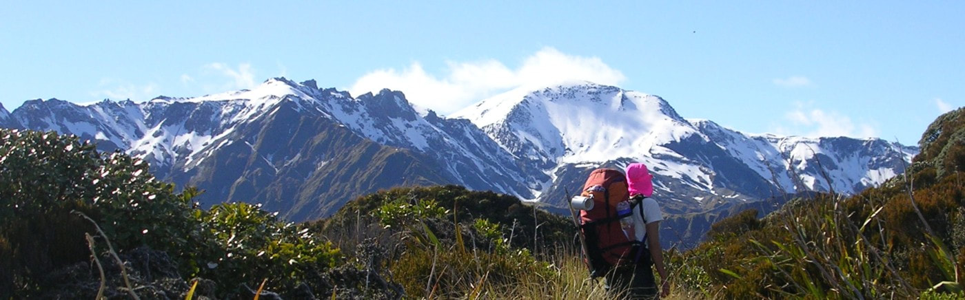
Galena Ridge and Mt Beaumont from Dickie Spur
Proudly powered by Weebly