Lake Morgan Hut
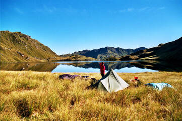 Lake Morgan's southern end.
Maintenance Status
Lake Morgan is a DOC maintained Hut. The most direct access to it is via the Brian O'Lyn route from the Haupiri valley. The tracked section from O'Shanessy Creek to the bushline is DOC maintained, but they are open to community input. Justin LeSueur has taken an interest in it and did some work on it in May 2022.
Location
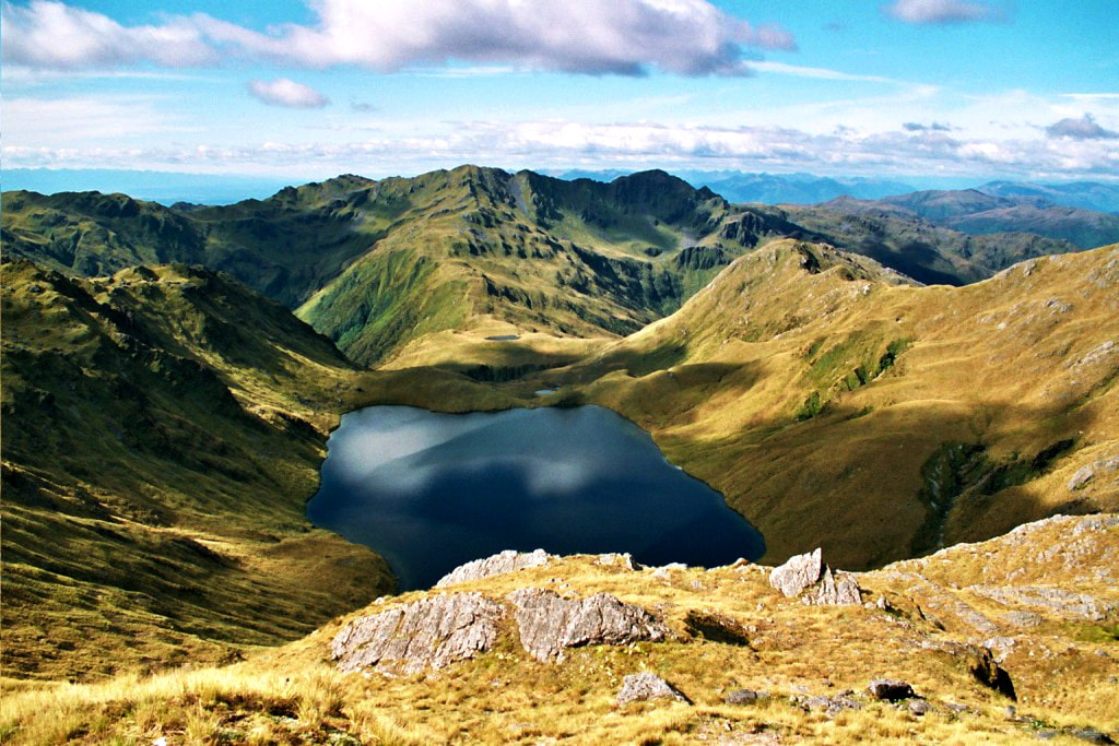
Crooked catchment. GPS Ref: E1494233/ N5275745 (BU21 942 758). Map BU21. 1090m altitude. Lake Morgan Hut is located just off the crest of the range that divides the Crooked and Haupiri catchments. It is perched on the TR of the Lake Morgan outlet creek above where it drops into a steep-sided gorge. The Hut is not visible from the crest of the range and GPS may be required to locate it in cloudy or wet weather. There is a large tarn on the crest directly above it. Lake Morgan Hut averages just under 20 visits per year currently. The tops in the vicinity offer easy travel and are liberally sprinkled with tarns and good camping spots. Lake Morgan is a stunning and serene spot is an easy half-hour amble from the Hut.
Access
The Lake Morgan route from the Haupiri valley starts at O'Shanessy Creek at the end of Heaphy Road which passes through Gloriavale Community land. Permission is required from the community who have provided a car park at E1495872/ N5281765 (BU21 959 818). A farm track continues from here to O'Shanessy Creek where the track starts and climbs steeply up the ridge on the TL of the Creek. The track is reasonably good, albeit a bit short of markers on the lower bush faces when heading down. Further up the ridge it becomes better defined and easier to follow, although there is still a bit of work required to clear back the flax and grasses at the top end. The odd waratah leads from the scrubline over the top of Brian O'Lyn. Sidle under Pt. 1251m towards the low point between O'Shanessy and Evans creeks, then up onto Mt O'Shanessy. Drop from the summit down its southern spur to the large tarn on the flat section of the range. Drop in SW direction from the tarn to the small bench where the Hut is located. There are a number of small tarns scattered along the tops section of the route. Allow around six hours in good conditions for the journey, although fitter types may manage it in less.
There used to be a track up the spur on the TR of O'Shanessy Creek, however the most recent information is decades old and described it as a pretty mean scrub-bash even then.
Lake Morgan Hut can also be accessed from the Crooked valley, often as part of tops circuit from the Crooked valley to the Haupiri, or vice-versa. The route starts just downriver from Top Crooked Hut. The track provides access to the bushline from the valley floor and was recut by DOC in February 2021 and apart from a little bit of regrowth is still in good condition. It commences on the TR of the Crooked River 100m downstream from the Hut. There is an orange triangle on the island between the two river braids and another on the TR bank at the track entrance, where a small stream runs against the bush edge. The track climbs steeply to the scrub line and it is marked with orange triangles and permolat. A band of boulders is crossed at the scrub edge onto a small rocky knoll that provides extensive views of the Crooked Valley. Waratahs and cairns lead from here up through some low scrub to an obvious high point, through a shallow depression, then in a NE direction to the crest of the Morgan Tops.
The last waratah is on a tussock ridge at 1420m (E1492850/ N5272930 - BU21 928 730) just below the top of the range. Travel is easy and reasonably level from here along to point 1489m. Drop to the saddle between point 1489m and point 1422m and down the obvious rocky gut below it to the Lake. The true right lake edge is followed around to the outlet creek. Drop down its TR crossing to a flat bench on the TL just below a small set of waterfalls. The bench has small tarns on it and Lake Morgan Hut is visible from here in clear conditions. Follow the creek down a bit, then sidle back over to the TR and around the 1120m contour line to the Hut. Allow 4-6 hours from Top Crooked Hut to Lake Morgan Hut in good conditions.
Type
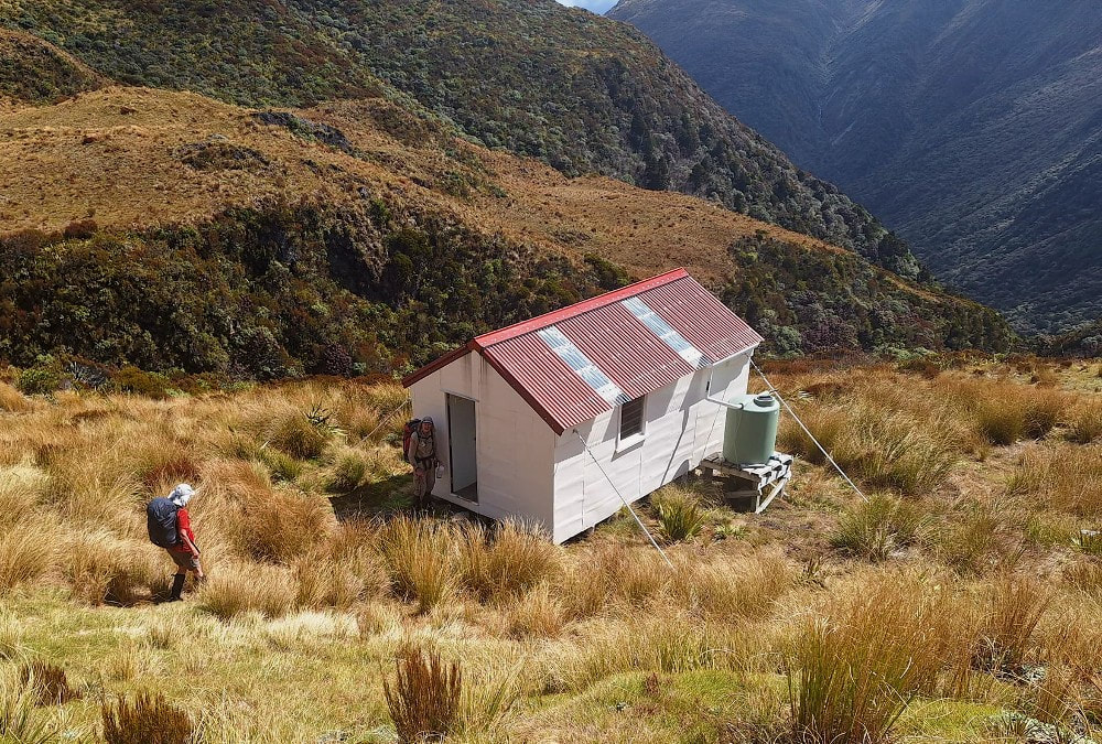
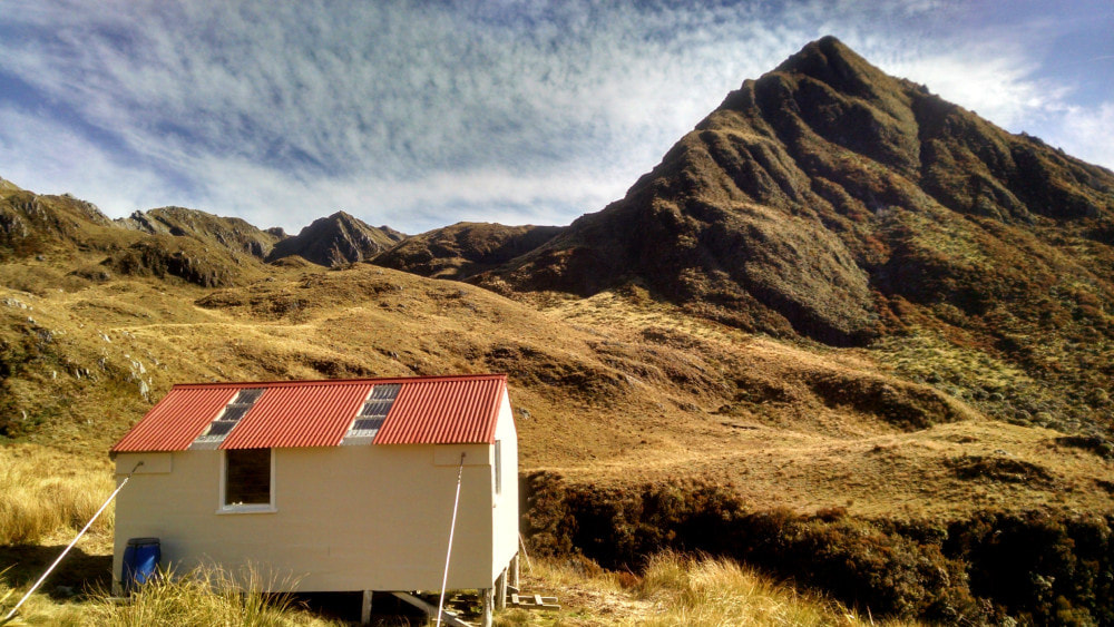
Lake Morgan Hut is a standard NZFS S70, 6-bunk design built in the 1970's. The cupboards at the door end were removed at some point to create more space. A toilet and water tank were installed by DOC in May 2021. The original toilet was destroyed by wind some years back.
Condition
Lake Morgan is in good condition currently. Some painting and resealing work was done in the summer of 2003/ 4 by DOC. In 2014 the Department installed tie-downs, painted window frames and doors, cleaned out the water tank and put netting over it to stop debris getting in. In 2019 DOC painted the Hut, replaced the Polycarbonate on the roof and a leaking tap on the water-barrel. Some damp patches were noted at the floor's edge under the end window, probably an issue with the flashing. The BCT helped funding the new toilet which was built by members of the Gloriavale community who are frequent users of the Hut. The door has unfortunately already been blown off. DOC Greymouth have been notified.
Routes
There is a really nice tops crossing from Lake Morgan Hut over to Cone Creek Hut in the Haupiri and the route is straightforward in good conditions. Access onto the crest of the range is possible in a number of ways, either directly up onto Pt 1343m, or via an obvious gut on the TR of the Lake's outlet creek. Once on top head along the side-spur towards Pt 1368m, dropping off at around E1494804/ N5274769 (BU21 948 748) into the basin below. Sidle out of the basin at around 1150m onto the spur on the TL and drop down towards where the two branches of the creek meet in the lower basin. The route out of the basin starts in the TL fork of the creek (GPS Ref: E1495592/ N5273875) and is marked with a cairn and permolat. It sidles across the hillside through patches low scrub and tussock to a saddle on the left of a prominent rocky outcrop. A gut filled with large boulders is followed down to a section of track that emerges onto an open scree at around 900m. The scree is very steep and active and is followed down to the Cone Creek track five minutes downriver from the Hut. The route from the basin down to Cone Creek was retrimmed and marked in October 2020. Allow two hours plus from Lake Morgan Hut to Cone Creek Hut, or 3-4 hours if travelling in the other direction.
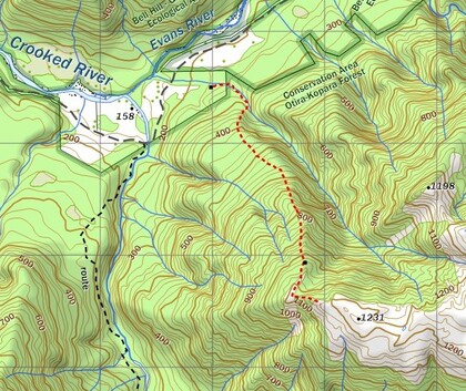 Morgan River tops route .
The tops on the TR of the Morgan River are very easy travel and provide an alternative route from Lake Morgan Hut down to the Crooked roadend. This avoids the transport issue you would face if doing the standard Crooked-Haupiri circuit. DOC Greymouth recently gave the go-ahead to Permolat to cut a track down a leading spur at the end of the range to make this a bit easier. This was completed in July 2023. From Lake Morgan Hut head up the SW spur of Mt O'Shanessy to around the 1280m contour, and sidle off here on the Morgan River side, and across an old scree to the dip just before point 1375m. There is a nice-sized tarn just beneath the dip. Travel along the range from here is straightforward and there are plenty of tarns and good campsites along the way. At the end of the range there is a cut and marked trail down the NW spur of point 1231m through a band of scrub to a bench with open tussock patches. The track proper starts at the lower end of the bench in an open area at 1030m (E1488851/ N5275925). It drops down the broad spur on the TL of the large unnamed creek that feeds the Evans River. It drops into the creek at around the 280m contour and follows it down a short distance emerging in open pasture at E1487992/ N5277517. Drop through the paddocks and across the old Rotomanu-Kopara Road and ford the Crooked just downstream of the old bridge site. The Crooked is generally OK to ford at normal flows but can be tricky or uncrossable at other times. Allow a full day to get from Lake Morgan Hut to the Crooked roadend. When coming from the Crooked end it's probably better to break the trip into two days and camp out on the tops. Allow 3-4 hours to reach Point 1231m from the valley floor.
A few parties have accessed the Lake Morgan tops from the spur directly opposite Jacko Flat Hut The accounts of their trips in the Lake Morgan hutbook are not encouraging and mention an extensive band of alpine scrub with bluffs between the 700m and 1100m contours. It would probably be quicker and easier to carry on up the valley and use the maintained track opposite Top Crooked Hut for tops access.
Repairs needed.
Some flashing/ sealing work may be required on the end window. The toilet door needs to be replaced with a sturdier model. More markers at the lower end and flax clearance at the top end of the Brian O'Lyn track is needed.
Provisions on site
An aluminium bucket and hand basin, an old NZFS first aid kit, a broom, a shovel, four billies, four fry pans, one pot, assorted cutlery and crockery, a five-litre solar shower, a portable camp stove, a hearth shovel and brush. There are various timber odds and sods under the Hut.
