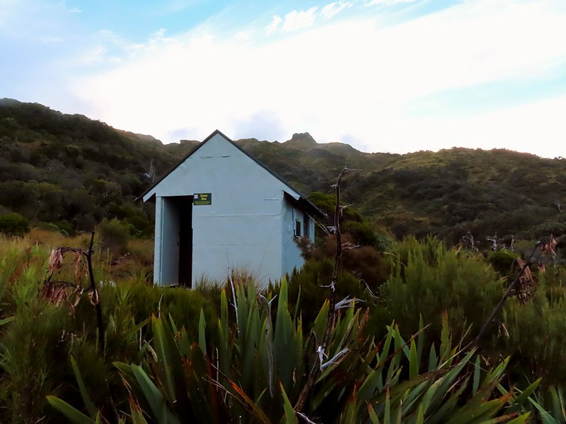
Stan's Hut
 The line I took up to Stan's Hut in 2022
Maintenance Status
Stan's Hut is designated for public use, overseen by the Department of Conservation, but owned and maintained by the NZ Chapter of the Safari Club Inc. It was built as a private hunting hut in 1985 by the late Stan Peterson of Hokitika who gifted it to the Club in the early 2000s. Stan probably built the hut to house his hunting clients after a New Zealand Forest Service Hut located on the next ridge up the valley blew off its piles sometime in the 1970s. Stan's Hut has pretty much always been the exclusive province of fly-in hunters. There are currently no maintained routes or tracks providing direct valley access to it and the rare foot visits have been by parties traversing the Price Range. The Permolat group has explored the option of putting a track in from near the Whataroa/ Perth junction but never heard back from DOC about it. Stan's Hut has a $5 per night fee for non-members which can be paid to the Safari Club NZ: 02-0636-0099560-00. The contact for bookings is 021-328-197.
Location
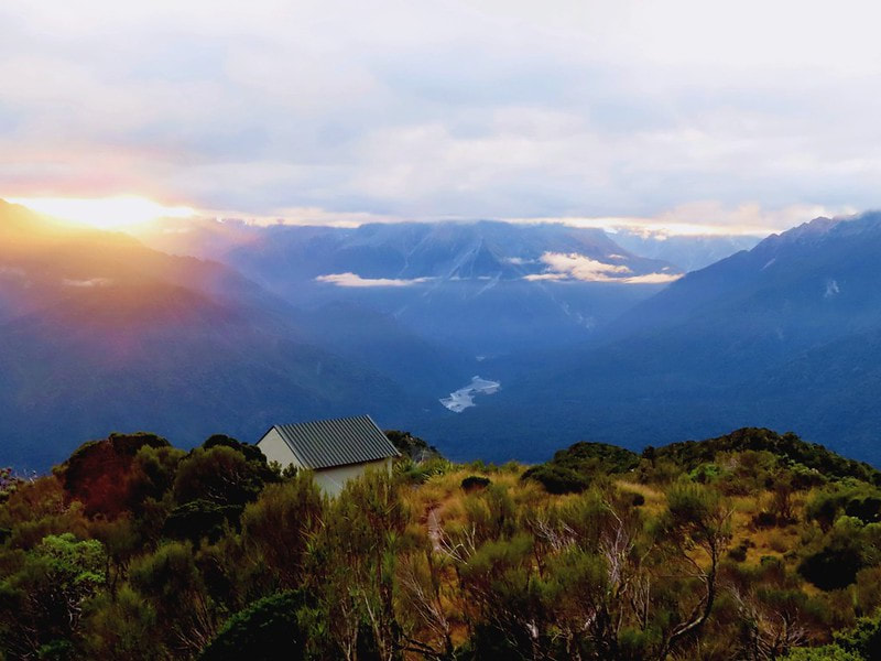
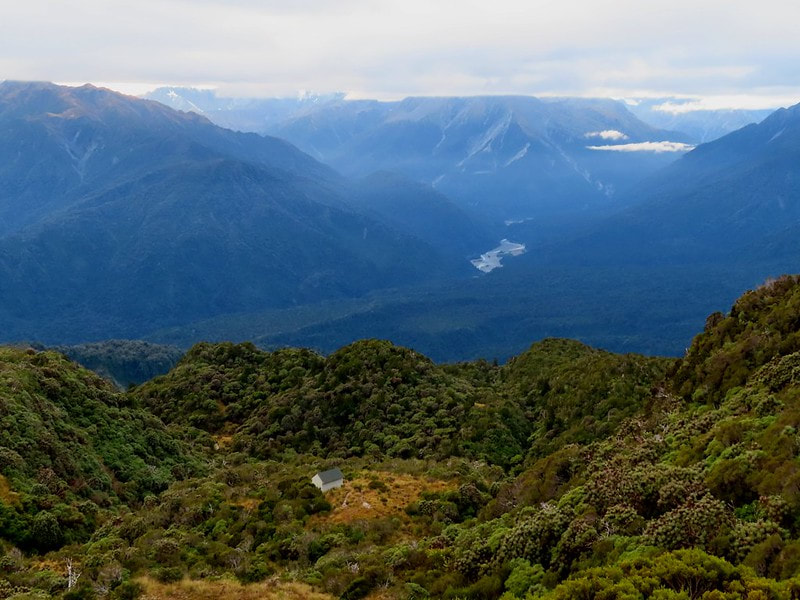
Whataroa catchment. Map BW16. GPS Ref: E1389518/ N5196435. Altitude 1056m. Stan's Hut is located on a tussock bench in the alpine scrub zone on the Price Range. The views out over the Whataroa and up the Perth valleys are breathtaking and the open tops behind the Hut easily accessed by means of a short section of track through the alpine scrub. Chamois and deer are the main attraction for the hunters who average around six fly-ins per year. There were only two foot visits recorded in the hutbook which went back to 2007 when I bashed my way up through the scrub in 2022. The last of these was in 2012.
Access
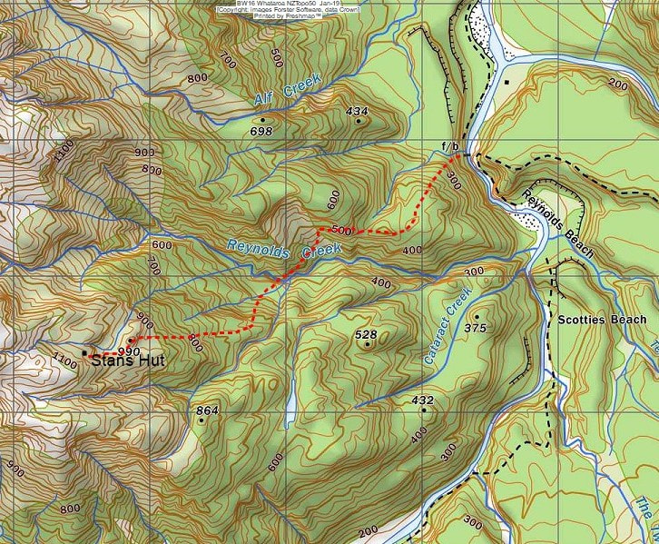
Historically, three NZFS tracks provided access to the Price Range from the Whataroa valley. These were accessed by swingbridges at Harry Creek, Jack Creek, and Butler Junction, the first two of which are long gone. The Harry Creek bridge provided access to a track leading up from the Gunn River confluence to the Gunn River Hut, the next ridge upriver from where Stan would later build his one. The river is not fordable here which makes reinstating the more direct route unworkable. Currently if you want to access Stan's Hut by foot the options are limited and none particularly easy or straightforward. It is possible as I did to bush bash from the swingbridge above the Perth confluence through the mid-section of Reynolds Creek and up the bush faces to point 990m just below the Hut. It's rough going with bluffs, some gorgy bits in Reynolds Creek, and dense alpine scrub for the last few hundred vertical metres. This is roughly the line Permolat proposed to DOC be cut and marked by the Group. Allow 8-9 hours from the road end for the current untracked version.
Tracked access up onto the Price Range is via the Gunn Ridge tops track from Butler Junction using the swingbridge there. DOC have deigned to close this route permanently due to severe erosion at the top end, but if you want to manage your own risks, the track was OK but starting to overgrow in places at last report in 2021. From the top end of the track, it is possible to sidle around the northern flanks of Gunn Ridge into the Gunn River basin. There is a small dry rock in the middle of the basin that can sleep two at a pinch. Mt Cloher can be approached up a tiny side-creek at BW16 856 937 on the TL of the stream draining it, or up the spur at BW16 850 939, then sidling across an upper basin to the peak. The rest of the Range around to Stan's is very easy travel in good conditions but it'd be a long day from Butler Junction and probably more sensible and fun to break it up and camp or bivvy out in Gunn basin. The top entrance to the track down to Stans is at E13893963/ N5196351.
Stan's Hut is designated for public use, overseen by the Department of Conservation, but owned and maintained by the NZ Chapter of the Safari Club Inc. It was built as a private hunting hut in 1985 by the late Stan Peterson of Hokitika who gifted it to the Club in the early 2000s. Stan probably built the hut to house his hunting clients after a New Zealand Forest Service Hut located on the next ridge up the valley blew off its piles sometime in the 1970s. Stan's Hut has pretty much always been the exclusive province of fly-in hunters. There are currently no maintained routes or tracks providing direct valley access to it and the rare foot visits have been by parties traversing the Price Range. The Permolat group has explored the option of putting a track in from near the Whataroa/ Perth junction but never heard back from DOC about it. Stan's Hut has a $5 per night fee for non-members which can be paid to the Safari Club NZ: 02-0636-0099560-00. The contact for bookings is 021-328-197.
Location
Whataroa catchment. Map BW16. GPS Ref: E1389518/ N5196435. Altitude 1056m. Stan's Hut is located on a tussock bench in the alpine scrub zone on the Price Range. The views out over the Whataroa and up the Perth valleys are breathtaking and the open tops behind the Hut easily accessed by means of a short section of track through the alpine scrub. Chamois and deer are the main attraction for the hunters who average around six fly-ins per year. There were only two foot visits recorded in the hutbook which went back to 2007 when I bashed my way up through the scrub in 2022. The last of these was in 2012.
Access
Historically, three NZFS tracks provided access to the Price Range from the Whataroa valley. These were accessed by swingbridges at Harry Creek, Jack Creek, and Butler Junction, the first two of which are long gone. The Harry Creek bridge provided access to a track leading up from the Gunn River confluence to the Gunn River Hut, the next ridge upriver from where Stan would later build his one. The river is not fordable here which makes reinstating the more direct route unworkable. Currently if you want to access Stan's Hut by foot the options are limited and none particularly easy or straightforward. It is possible as I did to bush bash from the swingbridge above the Perth confluence through the mid-section of Reynolds Creek and up the bush faces to point 990m just below the Hut. It's rough going with bluffs, some gorgy bits in Reynolds Creek, and dense alpine scrub for the last few hundred vertical metres. This is roughly the line Permolat proposed to DOC be cut and marked by the Group. Allow 8-9 hours from the road end for the current untracked version.
Tracked access up onto the Price Range is via the Gunn Ridge tops track from Butler Junction using the swingbridge there. DOC have deigned to close this route permanently due to severe erosion at the top end, but if you want to manage your own risks, the track was OK but starting to overgrow in places at last report in 2021. From the top end of the track, it is possible to sidle around the northern flanks of Gunn Ridge into the Gunn River basin. There is a small dry rock in the middle of the basin that can sleep two at a pinch. Mt Cloher can be approached up a tiny side-creek at BW16 856 937 on the TL of the stream draining it, or up the spur at BW16 850 939, then sidling across an upper basin to the peak. The rest of the Range around to Stan's is very easy travel in good conditions but it'd be a long day from Butler Junction and probably more sensible and fun to break it up and camp or bivvy out in Gunn basin. The top entrance to the track down to Stans is at E13893963/ N5196351.
 Stans Hut prior to modifications
Type
Stan's Hut is a unique design, not having been constructed by a government agency. Stan initially had a tent camp at the site from where he operated his hunting safaris and in 1985 got permission from the NZFS to build a hut there. This was your standard shed-type structure with four bunks and a side and front window. It was a basic wooden frame with flat iron cladding walls and roof. A few years after it was gifted it began to leak badly and DOC were going to pull it down so in 2007 custodian Garry Mullings took a team in to affix a new steel tray roof and new trusses. The material from the old roof was used to build an enclosed porch and the main door was shifted out into this. The hut roof interior was lined at the same time. In 2022 a solar panel and battery was fitted along with internal and porch LED lights, and USB ports. There is a toilet with great views and water is from a small creek 20 metres from the Hut.
Condition
Stan's Hut is in good condition currently. In 2022 a joint NZDA/ SCI project led by David Keen and funded by BCT carried out a complete external paint (with paint supplied by Dulux), fitted new stainless tie-downs and anchors that were re-dug and concreted. The solar system was installed along with various other minor weatherproofing and drainage tasks. The toilet also benefited from new tie-downs, and a repainted door. The Hut has a hardly noticeable downhill lean and Gary thinks it could do with levelling at some point.
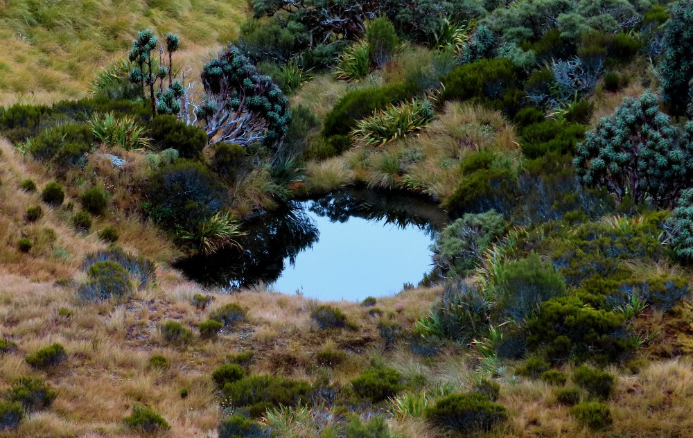 Tarn on the Price Range
Routes
The Price Range north of Stan's is good travel as far as Fardowner Peak. It is easiest to sidle across the benches east of Gunn Peak to avoid a rough piece of ridge. The main ridge NW of Fardowner Peak is initially steep but traversable, however the section just before Pt. 1522m has guts and rotten rock walls that make further travel along the crest impossible.
The east ridge of Fardowner leads down to Pt. 1106m and the top entrance of a track cut by locals up from Big Creek. It is likely to be a bit overgrown but is still usable. It starts on the saddle to the west of 1106m, goes down 20m, then heads sharp right and climbs back up through the scrub for quite a bit towards Pt. 1106m (not very logical). Once on the spur it starts dropping again. It is marked with blue plastic triangles down to 350m after which it is permolat and a bit of cruise-tape. The triangles are covered with black mould and are not very easy to spot. The bottom entrance is at E1390282/ N5200669. There is a steepish climb from the creek up through a band of kio kio (blechnum fern) onto a hardwood terrace. The track then heads upstream and inland before making its way toward Pt. 1106m.
There is also an unofficial route up onto the Range from the Waitangitāhuna valley up the spur on the TR of Darnley Creek. The track is easy to locate from Point 1273m by following the spur NW from BW16 835 984, initially on tussock, then sparse scrub to a cut permolatted trail. This is easy to follow through the scrub down to 700-800m where it becomes much less distinct and harder to follow with diverging deer trails and windfall. The markers are frequent however and with care, one can manage to stay on the line. The drop-off point can be accessed from the Price Range down a shingle gully at BW16 865 975. Use the spur on its TL further down to avoid the incised part of the creek. After this it is possible to sidle around through gullies and lush greenery to a side-creek at BW16 851 978, which can be used to access the tussock shelf above. Some Whataroa locals are planning a recut of the route this year some time.
Repairs Needed
The Hut could do with levelling at some point although the lean is hardly noticeable. A track up from the Whataroa/ Perth swingbridge would be a great idea and open the hut up to foot access.
Provisions on site
The Hut is well-provisioned with cutlery, crockery, pots and pans. There is also a camp oven, about 10 years supply of toilet paper, and kilos of salt. There is a first aid kit, broom, hearth brush and shovel, two plastic basins, four chairs, four plastic chairs, a shovel. a rake, and two solar showers.
