Kiwi Flat Hut
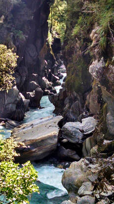 Morgan Gorge from the swingbridge
Maintenance Status
Kiwi Flat Hut and its access track up the TR of the valley are fully maintained by DOC.
Location
Waitaha catchment. GPS: E1416735/ N5221676 (BW17 167 217). Map BW17. 265m altitude. Kiwi Flat Hut is located on the TR of Whirling Water, 400m upstream from its confluence with the Waitaha River. The Hut sits adjacent to the large river flat from which it derives its name and the bush around it a mix of podocarps, rata, and hardwood. Kiwi Flat is a relatively easy three-hour jaunt from the road end and a first stop for those heading further up the Waitaha valley. Despite its accessibility Kiwi Flat has historically been quite low use. Things have ramped up considerably over the last couple of years with 40 visits in 2021 and 67 in 2022. A fair percentage are these are either bound for Ivory Lake in the head of the valley or doing an increasingly popular traverse of the Smyth Range.
The Morgan Gorge
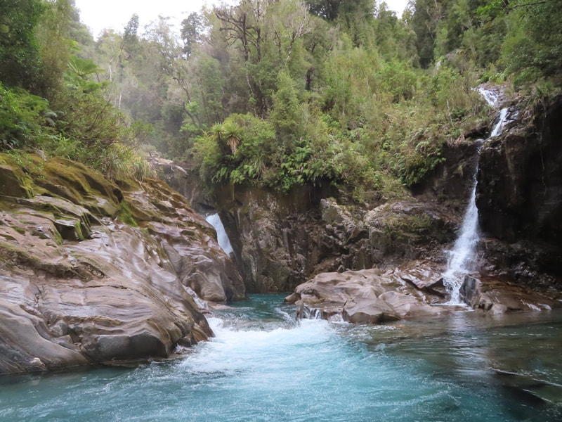
The swingbridge at the bottom end of Kiwi Flat spans the top entrance of the spectacular Morgan Gorge which kayakers view as one of the most challenging stretches of white water in the country. An application by Westpower to construct a run of the river hydro scheme from a weir and tunnel at the bridge site was declined some time back by the minister for the environment, however it has recently been resubmitted with the backing of the National and ACT parties. Although promoted as environmentally friendly, the proposed weir would take out three quarters of the water flowing into the Gorge, completely altering the character of this beautiful natural feature. The Westpower proposal includes the option of putting a road up to the weir site which would wreck the lower valley and compromise foot access up the North bank.
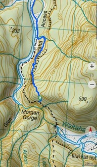 Actual trackline around the Morgan Gorge (blue line).
Access
The DOC maintained track to Kiwi Flat follows the TR of the Waitaha valley and starts at a sign-posted car park at the end of the North Bank Road. From here a narrow strip of land between the farm fence and the river is followed to some low bluffs abutting Point 202m. The river has recently cut in below the bluffs and a rough track has been cut through the bush to detour this bit. There is another detour track around the bluffs which isn't necessary at normal flows at the moment. Instead, you can ford a shallow braid of the river that cuts in against the bluffs and follow a short stretch of riverbed to reconnect with paddocks and a farm road that takes you to Macgregor Creek. The first section of the farm road around the back of Point 202m is not currently open to public access.
From Macgregor Creek the river is followed for around half an hour to the start of a track at the unnamed side creek at E1415316/ N5224873. The original route continued further upriver before climbing up and around the Morgan Gorge and is still incorrectly marked on NZ Topomaps. The new route follows up the aforementioned creek for a couple of hundred metres, then exits and climbs steeply onto a bush terrace (there is a ladder and chain at the top of this pitch). The track follows the terrace for a bit then climbs steeply up to 390m, crossing a broad spur, then dropping back to onto a series of benches above the Gorge. This section of the track is uneven underfoot, poorly drained, and boggy in quite a few places. It eventually drops down to the Gorge entrance at the bottom of Kiwi Flat and crosses the swingbridge to the TL. Follow the flat to a short section of track over a low bush promontory to Whirling Water, which is usually easy to ford at normal flows. The track up onto the terrace where the Hut is sited starts 200m up Whirling Water on its TR. Allow 3-4 hours to get from the roadend to Kiwi Flat Hut.
The original Kiwi Flat route went up South bank of the Waitaha until a row between DOC and the top farm owners led to this being abandoned. To the best of our knowledge public access up that side continues to be difficult although the route is still useable, despite starting to get rough in a few places. It is accessed via an old farm track from one of the top paddocks which leads to an old bulldozed cutting down to a flood channel on the riverbed. Follow this upstream for a few hundred metres to where it joins the river just below Douglas Creek. Andre and Corina Winkelman did some trimming and cruise-taping down to the flood channel and through a section of bush terrace to Douglas Creek in 2019. From Douglas Creek the riverbed is followed to Glamour Glen where the track enters the bush and climbs around the Morgan Gorge. A short distance along there are two large, recent slips about 100 metres apart that have wiped out the original trackline. Andre and Corina marked a route across these. A bit further along there is a regenerating slip that is provides access down to a hot spring down in the gorge (approx. E1415214/ N5222445). The last bit of the climb down is very exposed and slippery, and use of a rope is recommended for this. The track continues sidling around the Gorge, eventually dropping back down to the river at the bottom end of Kiwi Flat. Allow 2-3 hours from the farm boundary to the Hut.
Type
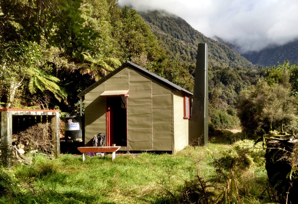
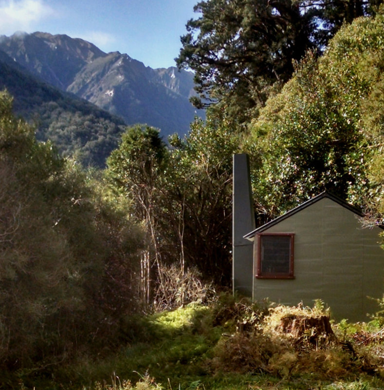
Kiwi Flat Hut is a standard NZFS S70 six-bunk design with open fire built in the 1960's. It was lined in the early 1980's and had one of the cupboards at the entrance removed to create more space. A water tank and woodshed were installed by DOC in 1987.
Condition
Kiwi Flat Hut is in good condition currently. DOC patched the chimney some years back, and in 2019 they re-piled the Hut, removed the lead head nails from the roof, and added new fly screens, a fire surround and a ceiling sheet. The hut was painted, and the toilet door and latches fixed. New mattress covers were provided.
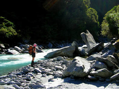 River section on the Moonbeam route
Upper Valley Tracks and Other Routes
After DOC ceased maintaining the tracks in the upper Waitaha in the early 1990's., the Permolat Group took an interest in keeping it all open. Starting in 2007 we have several track cutting forays into the valley, the last being in October 2021.
The track from Kiwi Flat to Moonbeam Hut Kiwi Flat sidles traverses some rough and undulating terrain but is currently in good condition. It starts at the Kiwi Flat Hut door and climbs steeply up onto a wedge of terrace that separates the Waitaha from Whirling Water. There is a half hour of relatively flat travel to the Headlong Spur turnoff after which the track drops off the terrace and begins a long sidle across the bush faces above the Waitaha Gorge. After about 20 minutes the track veers sharply uphill and climbs to 510 metres to get around two large active slips, before dropping back to the original trackline and continuing upvalley. There are a number of ups and downs before it starts descending to the river just upstream of Mark Creek.
From here it is around an hour's boulderhopping, with a couple of small bush detours to Moonbeam Hut. Moonbeam Torrent, a short distance downriver from the Hut, is large and swift and usually impassable after heavy rain. The track up to the Hut starts on the riverbed 10 minutes upstream from the Torrent and climbs steeply 60 vertical metres onto the terrace on which the Hut is located. Allow 4-5 hours to get from Kiwi Flat to Moonbeam Hut.
The track from Kiwi Flat to Scamper Torrent Hut has been reliant on volunteer input for some years now. A bit of work was done on the bottom end by some Permolat folk in October 2021 and more trimming and marking was done up to the 935m contour in August 2023. The rest needs a bit of work but is still fine to follow. The track starts 75m up the TR of Labyrinth Creek at the bottom of Kiwi Flat. It climbs steeply out of the creekbed, then flattens and ascends a sloping bush terrace to the foot of a narrow spur. The climb from here is steep and unrelenting up to point 1125m on the broad ridge bounding the TL of Scamper Torrent basin. Waratahs lead from the crest down to a short section of track through a band of alpine scrub to the basin floor. It is a 10-minute walk from here upriver to the Hut which is located up on a terrace on the TL. Allow 2.5-3 hours for the journey from Kiwi Flat Hut to Scamper Torrent Hut.
The track up Headlong Spur starts 1/2 an hour up the main valley track from Kiwi Flat and provides access to the Smyth Range. This was recut by the Hiking NZ crew in March 2021. The Headlong Spur route forms part of a three-day alpine circuit encompassing Kiwi Flat, the Smyth Range, and Scamper Torrent. There is one steep section on the Smyth Range bordering the Kea Glacier which is generally snow-free from late summer but would require ice axes at other times if conditions were icy. Most of the Range is relatively easy travel however, and there are plenty of good campsites. Scamper Torrent is accessed by dropping in a WNW direction down some sloping benches under Mt. Durward into the small basin on the lee side point 1397m. Follow the small stream from the basin to where it drops over a waterfall and continue sidling West across the tussock faces onto the broad spur bounding the TR of the main branch of Scamper Torrent. This spur has a small creek bisecting it. The high ground on either side of the creek can be followed through patchy scrub down into the main basin. The Hut is visible most of the way down from Durward in fine conditions.
County Hut can be accessed by means of a high traverse of Mts. Neville and Barry. There is a bit of permanent snow on these two peaks, and it is advisable to carry an ice axe at most times of the year. There is a steep, exposed section of Clearview Spur below point 1945m that requires downclimbing. The route from Clearview Spur into County Stream is down the faces on the TL of Canary Creek. Drop into Canary Creek for the last couple of hundred metres to avoid a band of alpine scrub just above the valley floor. A fit party may be able to get from Kiwi to County in a day over the tops, but it makes more sense to camp out and break the journey in two.
Smyth Hut in the Wanganui can be accessed by dropping off the Smyth Range at point 1830m. The upper Smyth River is good travel down to just below the Bradshaw Creek confluence. From here the going gets bouldery and rough. While this route could theoretically be done in a long day from Kiwi Hut by a fit party, it would be more sensible to allow two. The swingbridge across the Wanganui just above the Smyth confluence was washed away in a flash flood in 2013.
Repairs
Nil required structurally currently. The regenerating bush around the hut needs serious cutting back. The Headlong Spur track would benefit from a bit more work on the smaller shrubs, flax and astelia trimmed between the 900m and 1000m contours. The Scamper track needs more trimming from 935 - 1100m.
Provisions on Site
Two billies, a pot, some small frypans, a broom, two aluminium buckets, plastic and aluminium wash basins, two axes, an old axe head, a slasher, a shovel head, a hammer, nails (various sizes) and staples, long tech screws, a philips screwdriver, a sealant gun and two tubes of sealant, 2 paintbrushes, 2 paint rollers plus three sleeves and a tray. Under the hut there is a wooden roof ladder, three lengths of plastic downpipe, a length of spouting, and a roll of No. 8 wire, some spare piles, paint and a roll of clearlight.
