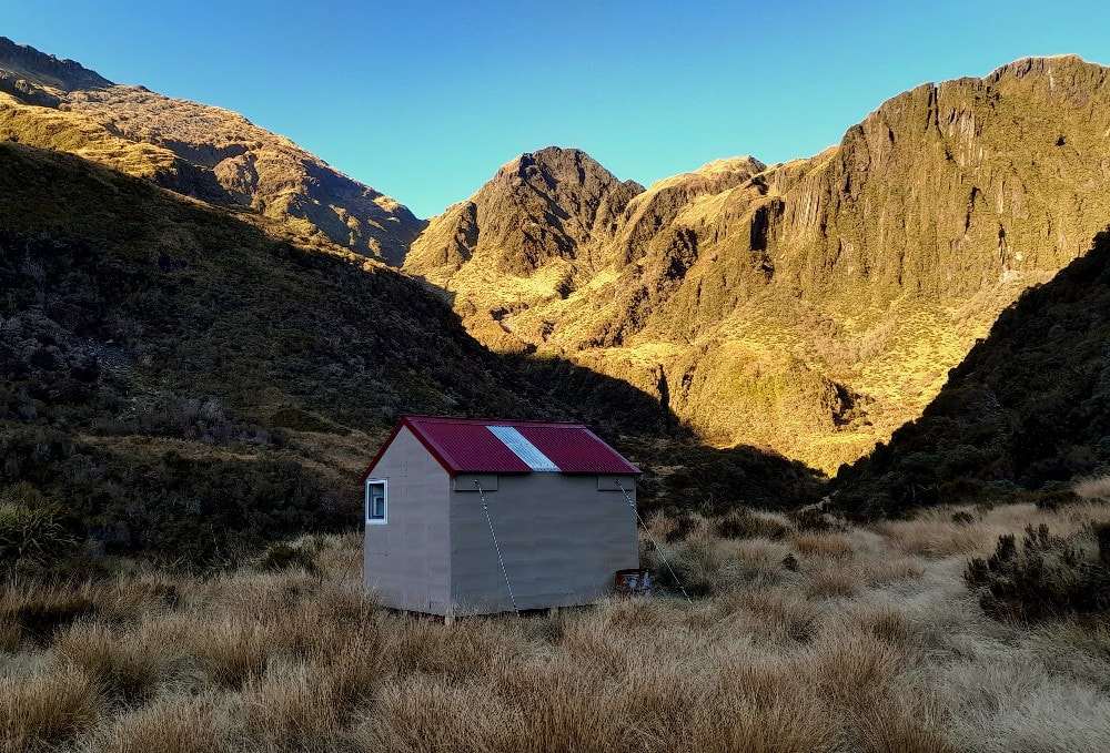
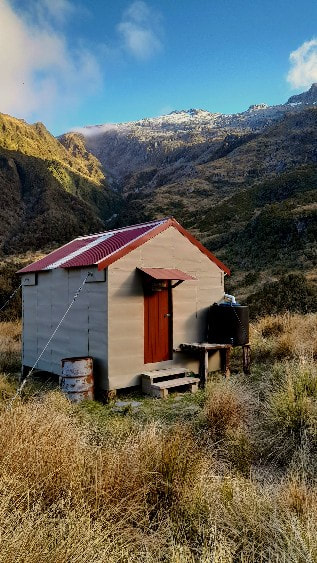
Scamper Torrent Hut
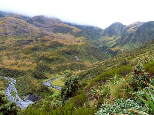 Scamper Torrent Basin and Hut
Maintenance Status
Scamper Torrent was designated as fully maintain by the Department of Conservation in their 2004 Review, however nothing of significance was done until 2021 when a major overhaul was carried out and a toilet installed. A bit of low-level maintenance had been carried out in the interim, mostly by volunteers. The access track has been kept open from the early 2000's by Permolat volunteers and other community minded types.
Location
Waitaha catchment. Map BW17. Grid Ref: E1416048/ N5219619 (BW17 161 197). Altitude 975m. Scamper Torrent Hut is located in the Waitaha valley in the upper basin of Scamper Torrent. It's a picturesque and remote setting that can be accessed in a day from the Waitaha roadend by a reasonably fit party. Scamper Torrent tumbles from the basin in a series of waterfalls down into Whirling Water, one of the Waitaha's larger tributaries. The Hut has historically been low use, although the frequency of visits has been increasing steadily over time. Visits currently average around 15 per year although 2022 was a bumper year with a record 29. A large number of the parties are doing increasingly popular traverses of the Smyth Range.
Access
The track up to Scamper Torrent basin from Kiwi Flat Hut has been reliant on volunteer input for some years now. A bit of work was done on the bottom end by some Permolat folk in October 2021 and the remainder of the track was trimmed and marked between August and November 2023. The track starts 75m up the TR of Labyrinth Creek at the bottom of Kiwi Flat. It climbs steeply out of the creekbed, then flattens and ascends a sloping bush terrace to the foot of a narrow spur. The climb from here is steep and unrelenting up to point 1125m on the broad ridge bounding the TL of Scamper Torrent basin. Waratahs lead from the crest down to a short section of track through a band of alpine scrub to the basin floor. It is a ten-minute walk from here upriver to the Hut which is located up on a terrace on the TL. Allow 2.5-3 hours for the journey from Kiwi Flat Hut to Scamper Torrent Hut, or 6-8 hours from the Waitaha roadend.
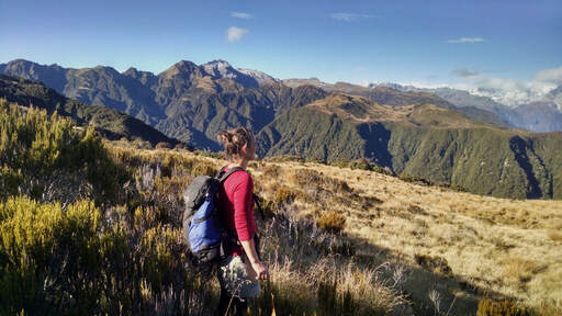 Looking over to Terra Quinn from Karnbach. Mt Durward is in the centre.
Type
Scamper Torrent was the last of the NZFS S81 four-bunk huts built in 1971 at a cost of around $1600. Its frame was treated pine and it was lined unlike many earlier S81s. The piles were untreated silver pine and are still pretty sound after 50 years. A small roof-fed water tank was installed in 2001. DOC installed a long drop toilet in 2021.
Condition
Scamper Torrent was well built and despite having had zero maintenance was still in good shape in 2001 when a DOC volunteer party went in and repainted it and installed the water tank. The work was financed by an unknown donor who was concerned about the state of the Hut. The DOC work maintenance in 2021 involved re-roofing, painting and weatherproofing the Hut, replacing the louvre windows with double glazed ones, replacing the old bench tops with stainless steel ones, replacing the tie-downs, and constructing a doorstep. The Hut is now in tip-top condition. The toilet door hasn't been designed well and its hinges have had to have been bent for it to close properly.
Routes
A good tops crossing is possible to Scamper Torrent over Karnbach and Mt Ashmore from the Wanganui valley. An old NZFS track starting in the head of the TR branch of Tarpot Creek was recut in 2017 and trimmed again in 2024. Head up the Amethyst Hydro access road for 400m to where it crosses Tarpot Creek. Follow the Creek up taking the TR branch where it forks. The creek above here has a fair bit of active slippage and a few small detours that skirt patches of windthrow. The track proper starts on the TR at 388m and exits the Creek where it begins to peter out at 460m (GPS Ref: E1408960/ N5219079 - BW17 089 191). It climbs steeply up a bush face and onto a side-spur that connects with Karnbach at point 1069m. The spur is steep in places, particularly a short section around 950m. A waratah with permolat marks the top entrance of the track at GPS Ref: E1409621/ N5218930 (BW17 096 189). The tracked section was tidied up in April '24 and is in good shape.
Continue up Karnbach following a rough trail along the ridge crest through a narrow belt of alpine scrub. The trail exits the scrub by some nice tarns (1409810E/ 5218976N) and from here sloping tussock benches can be followed up the Amethyst Ravine side of the ridge. Sidle under Mt Ashmore and reconnect with the main ridge where it drops down to point 1199m. Climb from here up and around point 1411m to point 1502m. Drop from here down the broad spur on the TL of Scamper Torrent basin to point 1125m where the route from Kiwi Flat crosses over. Access to the basin can be gained from a number of points further up the spur but it is hit and miss dropping down due to bands of thick alpine scrub not visible from above. Allow a full day, 9-10 hrs and good conditions, to make the crossing.
It is also possible to cross from the Wanganui using an old NZFS track up Terra Quinn that starts from the old weir site in the Amethyst Ravine (E1407837/ N5217252). The track is no longer marked on NZ topomaps but has had the odd bit of work done on it from 2014 onward. In 2024 it was cleared up to the 600m contour above the Bryan Hill saddle and flagged from here to the bushline. The top entrance of the track is at E1411026/ N5217367. Terra Quinn has some reasonable sized tarns and good campsites above the bushline and leads onto Carls Ridge. There are great views over to the peaks of the Garden of Eden from here. Travel up the ridge to the crest of the Smyth Range is reasonably straightforward with one exposed section around 1500m. Access down to Scamper is via the couloir that drops from the saddle SE of point 1684m to the obvious basin below. From here you sidle around to the broad spur that bounds the TL of Scamper Torrent and follow this down. There are a few snow poles lower down on this route the Hut should be visible from point 1684m in clear conditions.
There is an old unmaintained branch of the Terra Quinn track at the 730m mark (E1408842/ N5216839) that takes you down into the Amethyst basin. I haven't been down it for 35 years and have no idea what shape it is in. Travel in the upper basin is pretty easy and it should be possible to cross from the headwaters over point 1502m into Scamper Torrent basin. Access down to the Hut would be the same as for the Karnbach Route.
Access up onto Mt Durward from Scamper Torrent is via the broad spur on the TR of the basin directly opposite the Hut. There are two snow poles at the base of the spur that are visible from the Hut. There is a deep gut between the poles and it's easier to head straight up from the first pole following an animal trail through a band of bog pine to the open tussock. Cross the gut further up around 1100m and continue up the spur to around 1300m, then sidle SE into the basin on the South side of point 1397m. Continue on a SE diagonal up series of smooth rock ledges to a rock gully that runs under the summit of Mt Durward. This connects with the crest of the Range just East of the summit. Travel along the Smyth Range is relatively easy for the next four kilometres. There is one steep pitch up through some rocky ledges below point 2025m that is usually snow-free from late summer but may require ice axes and crampons at other times, particularly when descending.
Headlong Spur is accessed by sidling from the 1920m contour across the Attic. The track up the Spur was last recut by the Hiking NZ crew in March 2021. The Spur track starts at the bottom end at the end of a terrace 30 minutes upriver from Kiwi Flat Hut. Allow three days for the Scamper to Kiwi circuit, with a night camping out on the Smyth Range.
Moonbeam Hut can be accessed from The Attic by dropping down into the TR fork of the first main side creek on the TL of Moonbeam Torrent. This is a very rough route with some obligatory scrub-bashing, and care needs to be taken. Moonbeam can also be accessed by continuing along the Range past Mt Neville and Barry and dropping down Clearview Spur. There is one steep exposed section on the Spur below point 1945m that requires down-climbing, but below this it is easy going. The Clearview Spur tops track was recut by Permolat in 2015 and retrimmed in 2021. It is well marked, drops down the narrow spur separating Dorothy Creek and Moonbeam Torrent, and is accessed from a dry gut in the head of Dorothy Creek. A track exits the TL of the gut in the alpine scrub zone and sidles up onto the ridge and takes you down to the Moonbeam Hut door.
County Hut can be accessed by dropping off Clearview Spur down the faces between Canary Creek and the next side creek down. A band of scrub near the bottom can be avoided by dropping into the Canary Creek for the last few hundred metres.
The upper Smyth River can be accessed from the saddle at point 1830m, NE of Mt Barry (travel gets difficult further along the Range). Once in the upper Smyth it is good travel down to just below the Bradshaw Creek confluence, after which it becomes bouldery and rough. The swingbridge across the Wanganui River just above the Smyth confluence was washed away by a flash flood in 2013. The Smyth Range crossing is for experienced parties with alpine skills. It would be prudent to take a tent and break the trip from Scamper Torrent to Smyth Hut into two days.
It is possible to drop off the Smyth Range from Mirage Knob via point 1533m. There are remnants of an old NZFS tops track on the spur between Ally Trickle and Even Flow Creek that leads down to near the Hunters Hut cableway. The steep step just below the 1500m contour is a bit sketchy but after this there is a good trail through the scrub. The old permolat line can be followed with relative ease to where it peters out 100-200m above the valley floor. The original track entrance should be somewhere behind the cableway on the TR of the Wanganui. There is no water until the flat section of ridge just south of point 1533m is reached.
Repairs
The Hut doesn't need any currently. The toilet needs stronger hinges and a stop at ground level would prevent the door swinging open in the wind and ripping them off. Some stain and a paintbrush have been left to do the Hut steps.
Provisions on Site
A rubbish tin that serves as a food drum, an aluminium wash basin, a large billy, a shovel, a slasher (with spare handle), a broom, a metal bucket, an NZFS First Aid cabinet (stocked with period items), assorted tins of paint and paint brushes, a small quantity of permolat, Under the Hut there are three home-made ladders, a length of 125x125mm treated pine, and a length of plastic downpipe.
