Rocky Creek Biv
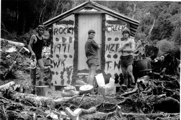
 NZFS builders Warren Keely, Tony Newton and Mario Gerimia.
Maintenance Status
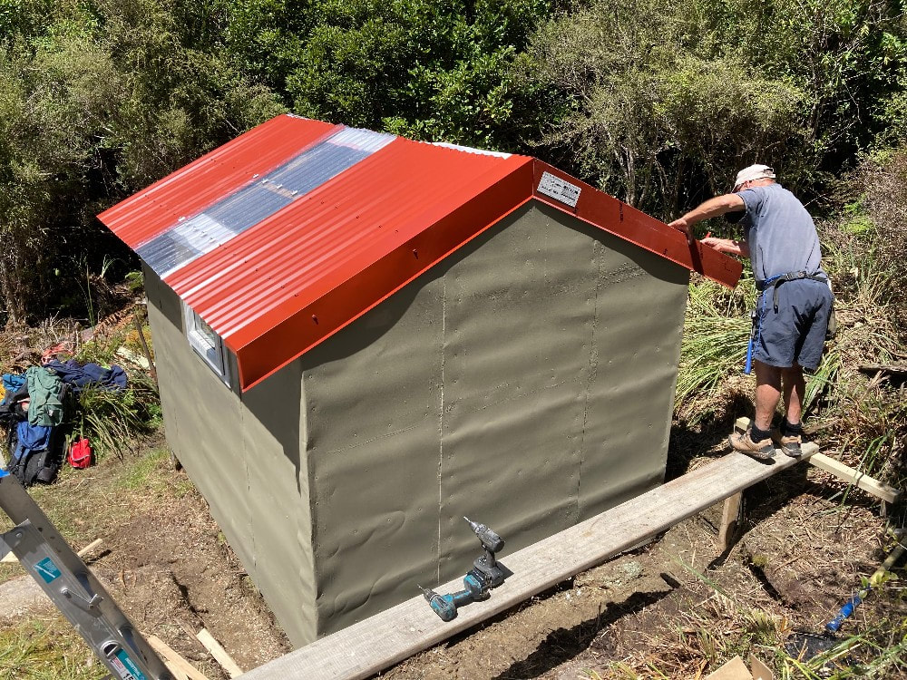
Rocky Creek Biv is designated as minimal maintenance by the Department of Conservation. In December 2022 Ollie Clifton of the Back Country Trust and a Kaimahi for Nature crew did a major overhaul on the Biv. The access tracks to Rocky Creek from the Taipo valley and Griffin Creek have been kept open by volunteers right through DOC's tenure. Frank King and Honora Renwick of Christchurch were key early adopters followed by Eigill Wahlberg and more recently Peter Umbers. In June and July '24 Eigill, who is doing predator work for DOC, reinstated the old bush detours that had left to overgrow after the Department took over from the New Zealand Forest Service.
Location
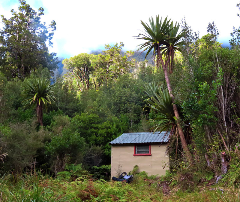
Taipo catchment. Grid Ref: E1469915/ N5261720 (BV20 699 617). Map BV20. Altitude 615m. Rocky Creek Biv is located on the TR of Rocky Creek in the Taipo River catchment. The bush surrounds are rata-kamahi forest and there is pleasant remote ambience here. Rocky Creek Biv has historically been low use, with numbers dwindling to a trickle during the 1980's and 90's due to deteriorating tracks and a lack of good route information. Visits have increased since the tracks were fixed up and the Biv profiled on this website. A lot of the folk visiting the Biv are doing a two-day Rocky Creek - Griffin Creek circuit, exiting from the Griffin via the Harrington Creek track to SH73 (or vice versa).
Access
The Rocky Creek route commences at the Taipo bridge on SH73 where it follows the TL of the Taipo River. A cut track starts at the top end of a grassy terrace and leads to the first side-creek. The terrace track starts on the TR of the creek and climbs steeply before levelling and sidling up the valley and into the Rocky Creek catchment. The track enters Rocky Creek at the bottom end of a small gorge. From where it is around two hours to the Biv. The creek section which was previously river travel is now mostly tracked thanks to Eigill. All the old NZFS detours have been reinstated and marked. You still need to cross the Creek several times but there is only about 200-300m of river travel now. The track up to the Biv starts on the TR of the Creek and is marked by a large cairn and permolat. It follows a small side-creek initially, then exits and sidles around to the Hut. Allow 3-4 hours from the Taipo Bridge to Rocky Creek Hut currently. This is a fine weather route and could be difficult or dangerous if the Creek were up.
Access to Rocky Creek Biv from the Griffin Creek catchment is over a low bush saddle. The route commences at the unnamed side-creek that drains Scottys Saddle, 15 minutes downriver from Griffin Creek Hut. A track goes a short distance up the TL of the creek, crosses, and climbs around into the next side-creek downriver. The track exits the creek a short distance up its TL fork and crosses into the TR fork above a small waterfall. It is a 10-minute climb from the head of this fork up to the Saddle. The track drops from here into Rocky Creek and this is followed downstream for around an hour to the Biv. This bit is a mix of creek travel and short, tracked detours. The multiple crossing and bits that you need to wade and would be difficult if the Creek was in flood. A DOC predator control team recut the section from Griffin Creek up to Rocky Creek Saddle in June '24 and Eigill did some work on the Rocky Creek side in July. Allow around three hours from Griffin Creek Hut to Rocky Creek Biv.
The clearing next to the Biv that provides helicopter access was cleared by Ollie's team in 2022.
Type
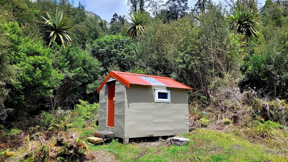
Rocky Creek is a one-off B143 high-stud design built in 1971. It has two sleeping platforms with mattresses. The original had louvre window on each side, and a cooking bench. It replaced a tent camp on the other side of the Creek that had been established sometime in the 1960's. The NZFS construction crew were Warren Keely, Tony Newton (Field Officer) and Mario Gerimia. Ollie's team replaced the louvre windows with single pane PVC ones and took out the cooking bench to create more space. The Biv is lined but has no heating or toilet. Water is from the Creek 50m away.
Condition
Rocky Creek is very well constructed and remained in good condition during a long period of zero maintenance in the 1980's and 90's. In 2004 DOC resealed and painted it, replaced the door, and made a few other minor repairs. Along with the window replacement, Ollie's crew re-roofed the Biv adding a skylight on the west side, they re-painted exterior and interior, replaced some of the internal ply lining, and dug a drainage ditch dug around the perimeter of the Biv. This will help hugely with moisture issues. Some accumulated soil from under the Biv was also removed.
 Scottys route
Routes
The saddle over into Griffin Creek is around an hour upstream from the Biv. It is visible from the Creek and has a large open slip on its northern side. The track entrance is 20 metres up the Creek past the slip.
Scottys Biv can be accessed by continuing up Rocky Creek past the Griffin Creek saddle turnoff. The creek narrows considerably, needs to be waded, and is steep and slippery in places. At around 1100m it forks and the TL fork is followed up. The fork steepens and peters out on an active scree. Climb onto the spur above the scree and continue up through a narrow band of low alpine scrub crossing a rock field just below the crest of the Range in a SW direction. The faces directly above this are very steep, and it is easier to continue SW over a narrow ridge before ascending the last bit (which is still pretty steep). Scottys Biv is visible from the top of the Range and can be accessed by following the waratahs down from point 1406m. Allow 2.5-3 hours from Rocky Creek Biv to Scottys Biv.
Repairs needed
None at the moment.
Provisions on Site
One billy, an aluminium basin, a large bowsaw, a shovel, a crowbar, a mattock, a jar of small nails, some red and white permolat, a hammer, two long pieces of tongue and groove, a coil of fine wire, a broom, two galvanised buckets, two bench seats, and a brush and shovel.


