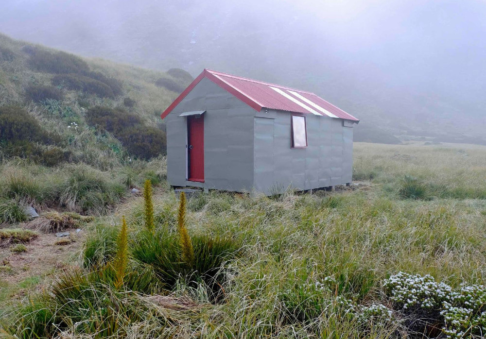
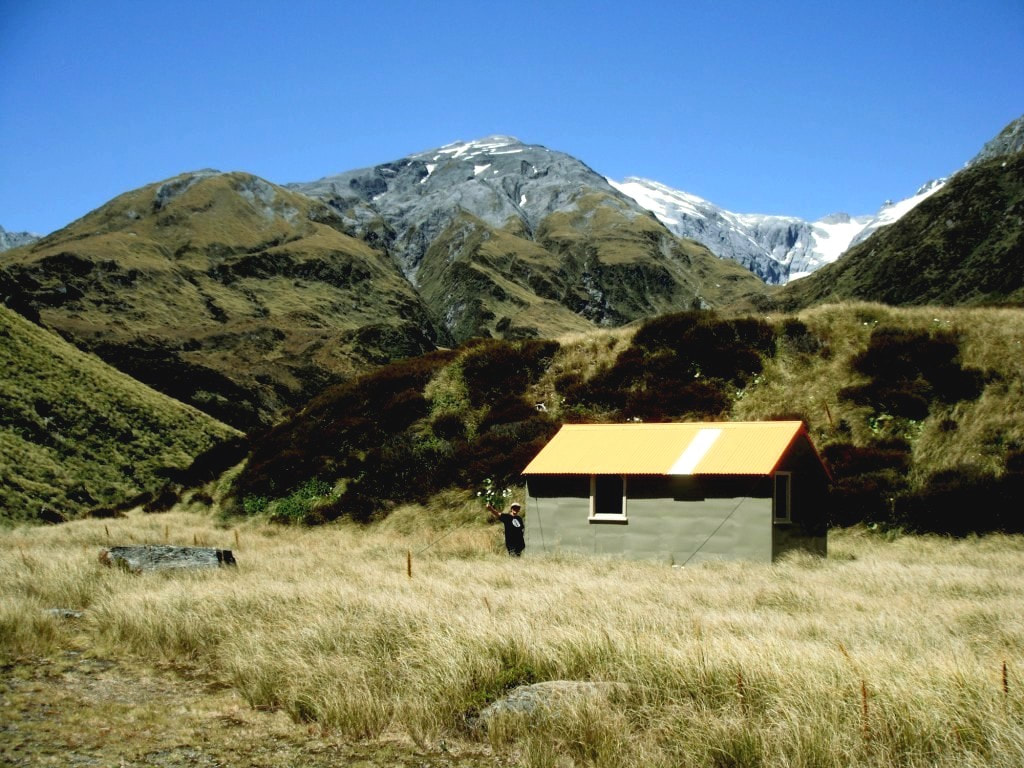
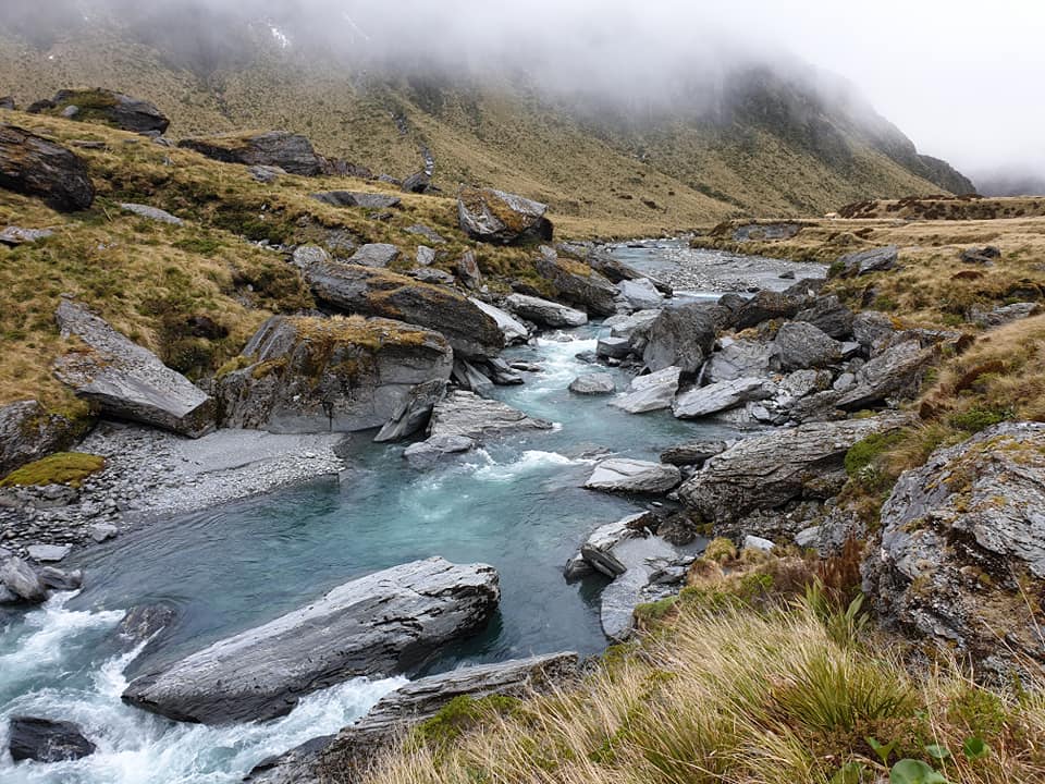
Top Waitaha Hut
 The Waitaha above Chainman Creek: Photo Mark Watson/ www.highlux.co.nz
Maintenance Status
Top Waitaha Hut was minimally maintained from 1987 when DOC took over from NZFS with nothing of note being done after 2004. Official maintenance of the tracked valley sections from Moonbeam Hut ceased around 1991 and was picked up by the Permolat group in 2011. Some Permolat volunteers repainted the Hut and did some minor maintenance in 2014. A group of volunteer firefighters and DOC staff did a one-off recut of the section of track around the Windhover Gorge in February 2019. In December 2020 Colin Morris of Permolat used some Back Country Trust funding to carry out a replacement of the roof, the louvre windows, and some moisture damaged interior lining, and repaint the exterior cladding. Colin went back in with Roger Woods in 2022 to install a toilet, also BCT funded.
Location
Waitaha catchment. Map BW18. Grid Ref: E1427288/ N5222410 (BW18 273 224). Altitude 1060m. Top Waitaha Hut is located in an expansive and beautiful tussock basin at the head of the Waitaha valley. It is a serene and remote setting backing onto the pristine snowfields and glaciers of the Mt. Evans massif. The alpine meadows and gently flowing river here are a total contrast to the wild and gorgy lower valley that must traversed to reach it. Top Waitaha Hut averages around 15 visits per year currently, up quite a bit from levels in the 1990's and early 2000's. DOC stopped maintaining the tracks in the upper Waitaha in the early 1990's and valley access became increasingly difficult until Permolat volunteers started getting involved in 2007. Most of the current traffic to the Hut is to or from Ivory Lake Hut.
Access
The route from Moonbeam Hut to Top Waitaha is tracked as far as Chainman Creek and this bit was recut by the DOC/ volunteer crew in February 2019. From here it untracked river travel. This upper section is notoriously long and rough with cascades, big boulders, and alpine scrub to negotiate. If it took you a lot longer than five hours to get from Kiwi Flat to Moonbeam Hut, we'd strongly advise you to reconsider continuing up the valley. There are sufficient tales of woe in the Moonbeam hut to reinforce this message, so ignore it at your peril.
From Moonbeam the track continues along the river terrace on the TL through a beautiful patch of montane forest (tall pahautea and totara). The track drops down a steep bank to the riverbed just before Dorothy Creek, re-entering the bush just past Alexander Creek. It sidles along the faces from here to the County turnoff, passing a reasonable dry rock just before the signpost. The main valley track drops from the turnoff down to the River and crosses the swingbridge to the TR. A short stretch of track leads to a section of riverbed which is followed to a small unnamed side-creek at the start of the Windhover Gorge. The track restarts 20 metres up the TL of the creek and climb/ sidles around the faces above the gorge, eventually dropping into a creek with attractive water-sculpted rock sides. A more serious climb begins here up the ridge on the TR of Chainman Creek. At around 900m the track drops off the ridge down a steep rib into the bottom end of Chainman Creek. It crosses Chainman Creek and cuts through a flat area with olearia scrub to the Waitaha riverbed.
For travel in the upper Waitaha above Chainman Creek it is best to stick to the riverbed and use bush detours where necessary. After around 2.5kms of very rough, slow travel the river opens out into a large, open tussock basin. The last bit to the Hut is an idyllic stroll compared to what preceded it. The average travel time from Moonbeam to Top Waitaha Hut seems to be around 11 hours. A few manage nine and a few a lot longer. A recent party that took 22 hours probably shouldn't have been in the valley. Travel on the river sections tends to be easier in winter when river flows are lower with less snow melt, and it is possible wade around some of the boulders or ford and cross back to get a better line.
Type
Top Waitaha is a Standard NZFS S70 six-bunk tops design built in March 1967. It was lined at some point, probably in the 1980's. Water is from the river. When the Permolat crew removed the inner lining during the recent renovations they found the building date and the hut number (288) pencilled on a rafter, but not the names of the builders.
Condition
Top Waitaha Hut is in good condition currently. In 2104 a Permolat work party repainted the exterior of the Hut and replaced a leaky windowsill on the west window. The cracked door was sealed and painted. Colin's 2020 team fitted a new roof, replaced both windows, improved the weather tightness of the door and painted the exterior walls. They also upgraded the sub-floor anchors, built a new concrete doorstep, installed wall anchors. so that DOC could upgrade the tie downs. They fitted new stainless-steel bench and tabletops, replaced several interior ply sheets, painted interior walls and ceiling, and cleared vegetation from around the hut. The toilet was installed in 2022.
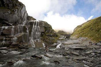 The Ivory Lake outlet creek cascades into Stag Creek: Photo Mark Watson/ www.highlux.co.nz 2008
Routes
The route from Top Waitaha up to Ivory Lake Hut is fairly straightforward. Follow the River up to the Reid/ Stag Creek confluence and climb from here up onto the tussock terraces on the TL of Stag Creek. There are numerous tarns on the bench, which tapers out further up where Stag Creek rises to meet it. Follow the Creek to where the Ivory Lake outlet creek cascades down some sheer rack walls. The Hut is on the lip of the cirque directly above and on the TL of the lake's outlet, but is not visible from below. Cross to the TR just past the outlet and follow a roughly diagonal line up a series of ledges onto the bench where the Hut is. Ice axes and crampons may be necessary on this bit in winter and spring. Allow around 2.5 hours for the journey from Top Waitaha Hut to Ivory Lake Hut.
A couple of possibilities exist for crossings from Top Waitaha over to Top Tuke Hut in the Mikonui catchment. The first is to follow the Waitaha River up to the confluence of Stag and Watson Creek and climb from here up the main western spur of point 1870m. Traverse points 1870m and 2084m. There is an exposed five metre pitch of crumbly schist just after Point 2084m that needs upclimbing which is often icy when snow covered. Someone left a fixed rope there in 2018 but this shouldn't be relied upon. Continue along the crest to the junction of Sawtooth Ridge and the SW ridge of Mt. Beaumont and drop from here down the broad spur between the two main upper branches of the Tuke. Drop from where the spur flattens at 1300m into the upper TL branch and follow it down through a section with large boulders and alpine scrub to where the River flattens. It is reasonably straightforward from here to the Hut with the odd tracked bit through scattered scrub on the TR. There is a track up to the Hut from the the small-side creek that comes in at E1428172/ N5226877 (BV18 282 269).
The other crossing involves a traverse of Ragged Peak and the Tusk and is accessed up the side-creek 100m downstream from the Top Waitaha Hut. Exit the creek on the TL around 1150m and climb due east onto the flat area North of Point 1328m. Continue up and over Ragged Peak and around the snowfield on the southern faces of The Tusk to the low point at the start of Sawtooth Ridge. Drop from into the gut below into the upper TL branch of the Tuke. Allow 5-6 hours for both crossings in good conditions. Snow gear should be carried right through to late summer - autum.
Dickie Spur Hut is accessed from The Tusk via Dickie Ridge. The section of ridge just SE of point 1920m has a number of short exposed sections, some over rotten rock. One in particular is marginal without a rope, so those less comfortable with this type of scrambling should probably consider carrying one. It's a long plod down Dickie Ridge to the Hut turnoff at around 1200m, which has an orange triangle on a stake and an older wooden stake with permolat next to it. The to the Hut is down a side-ridge in a NE direction and the trail is poled. The Hut is located on a tussock bench just off the side-ridge and requires good visibility to locate.
The Cropp Basin can be accessed over Mt. Beaumont and travel from the Sawtooth Ridge junction to Beaumont is very easy. Mt. Beaumont has permanent snow on its summit and a very small glacial remnant on the summit's South face. Drop down to point 1898m from Beaumont and sidle NE to point 1695m. Continue North for 500 or so metres, then drop due East into the South branch of the Cropp. A waterfall in the South branch at around the 1000m contour can be negotiated on a rock ledge on the TL. Further down in the Cropp Basin travel is easy with good campsites on the TL where NIWA has its meterological equipment. The remains of Cropp Hut were choppered over the River from the TR and can also be found here.
From the summit of Mt. Beaumont it is easy travel down Steadman Brow to the top of a maintained track that provides access down to the Price Flat swingbridge in the Whitcombe valley. Its entrance is on a side-spur that connects with the Cropp Brow on a flat area just NE of Cropp Knob. The track was last cut in 2013 and it takes around two hours from the scrubline down to the bridge.
Healey Spur Hut can be accessed by continuing along Galena Ridge from Mt. Beaumont. Travel along the Ridge is relatively easy with one steep little notch between points 2001m and 1974m that requires downclimbing. It is very exposed and a rope may come in handy here Healey Spur is down a steep rib of tussock and loose rock when snow-free. There is a dip at the bottom of this, followed by a short razor-backed section that can be traversed with care, or avoided by dropping onto the tussock slopes on the Healey Creek side and sidling between the 1500 and 1600m contours. It is necessary to climb back onto the Spur either SE or NW of point 1643m due to deep slots that prevent a direct sidle down to the Hut. Allow a full day in good conditions from Ivory Lake Hut to Healey Spur Hut. Ice axes and crampons should be carried on this route during the colder months of the year.
A traverse of the Hitchen Range is possible from the Top Waitaha Basin with access up the SE spur of Ragged Peak. Travel is reasonably straightforward from here along to Ridland Saddle. There are a couple of short steep downclimbs West of Ragged Peak and one narrow crumbly section of ridge just before Point 1721m none of which are particularly difficult when snow-free. Some steep exposed sections West of Mt. Hitchin can be avoided by dropping down the ridge on the TR of of Isobel Creek from Ridland Saddle. Drop into Isobel Creek at the 1130m contour and head up the side-creek that comes in on the TL there. Around 100m up the side-creek there is a steep rocky gut on the TL that provides access onto the open tops just below a bench with tarns, 500m SE of point 1385m. Head over point 1385m and sidle across the SW slopes of Mt. Allen at around the 1300m contour onto the broad spur at the head of Robinson Slip Creek. The very top of the slip is vertical but can be accessed from a gut that drops off the spur around E1419806/ N5226210. Sidle South out of the gut at 1150m (GPS Ref: E1419652/ N5226217), across an eroding face onto the main slip. The top of this is very steep and rough underfoot down to the 700m contour, then eases off. The creekbed is followed down to Macgregor Creek which is followed down to the Waitaha.
An ancient NZFS route from the top of Swandri Spur down Slip Creek to Polluck Creek Hut in the Kakapotahi is not safe, or recommended. The top of the slip is vertical and eroding and there is a waterfall with steep exposed sides further down. Dropping down Swandri Spur itself is reportedly a long and unpleasant scrub-bash.
To cross from Top Waitaha to County Stream Hut a number of lines look possible from the Hut more or less directly up to point 1857m. Traverse Mt. Bloomfield from here and drop to a point just above the col between it and Artist Dome. A cairn here marks the drop-off down to a steep rib between two forks of Bloomfield Creek. It is easier initially to drop down the rocky gut on the TR of the rib, then sidle back onto the rib to avoid some waterfalls further down where the gut turns into a creek. Follow the rib down to Bloomfield Creek and from here down to the County. The access track up to the Hut is on the TR of the Bloomfield just up from the County confluence and is marked with a cairn and permolat.
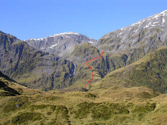 Reid Creek route
There is an alternative route to the County that takes in the lake in the South branch of Reid Creek. Head up to the Stag - Reid Creek confluence and climb up through a band of patchy alpine scrub onto the terrace on the lower TL of Reid Creek. Cross the terrace and drop into the West branch of Reid Creek just above its confluence with the middle branch. There is a steep short scrub-bash up onto the ridge that divides the middle and west branches, which has a daunting looking bluffy face further up. There is however a reasonable route up through a series of tussock benches and ledges and around into the small side-creek on the TL of the spur, just above its waterfall. The side-creek becomes a narrow, dry slot further up and leads onto a flat bench South of point 1686m. Continue South along the bench and the eastern slopes of the lake towards the col at point 1892m. The route from here down into the County is the same as for the Mt. Bloomfield traverse.
A trip to Reid Lake from Top Waitaha Hut is certainly worthwhile if time and weather permit. An awesome slot gorge just below the Lake can be negotiated by terrace-hopping on the TR.
Repairs needed
Shouldn't be any now.
Provisions on Site
One aluminium bucket, one billy, two large camp ovens, one frypan, one aluminium basin, one large plastic basin, an egg beater, two scrubbing brushes, a hearth brush and shovel, a broom, a shovel, a slasher, a hammer, a box of assorted nails (jolthead and flathead), a tube of sealant and a sealant gun, a packet of small normal screws, a spare slasher handle.
