Top Tuke Hut
Maintenance Status
Top Tuke Hut and the tracked sections up the Tuke valley to it are designated as fully maintain by the Department of Conservation.
Location
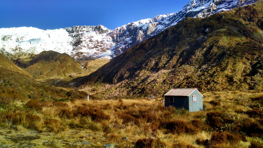
Mikonui catchment. Map BV18. GPS Ref: E1428224/ N5227042 (BV18 282 271). Altitude 1000m. Top Tuke Hut is located in the head basin of the Tuke River, which is the main tributary of the Mikonui River. It is a remote, beautiful and very rugged setting, ringed by the peaks of Galena and Dickie Ridges. The mid Tuke valley is spectacularly gorged and impassable with large waterfalls. Foot access to the Hut is exclusively via the tops and the higher sections of the routes in and out of the valley are usually snow covered from winter through to early summer. The snow tends to burn off in most places by late summer and the tops often remain bare until early winter, aside from a few patches of permanent snow and glacial remnants. Extreme weather and snow can occur at any time of year however and ice axes and crampons may be necessary during the colder months for some of the crossings. Visits on foot to the Hut were historically infrequent but have picked up in recent years due to increased popularity of Ivory Lake Hut and the Tuke as an access route. The last three years have averaged around 15 parties, mostly ivory baggers, with record numbers hitting the place in the summer of 21/22. The most direct access to Top Tuke is from the Mikonui roadend via Dickie Spur, with increasing numbers of crossings from Ivory Lake or Galena Ridge.
 Upper Tuke Gorge - Photo Andrew Buglass 2007
Access
Access to Top Tuke Hut is from the Mikonui valley and Dickie Ridge. Follow the poles from Dickie Spur Hut back up onto Dickie Ridge. Continue climbing up and over point 1326m to a dip in the ridge around point 1296m. Poles lead from here down some steep tussock faces into an unnamed creek which is followed down into the valley. On NZ Topomaps the descent is marked incorrectly on the spur on the TL of the creek. A track exits the creek on the TR around the 800m contour, sidles upvalley for 15 minutes, and drops into the riverbed at the top entrance of the Tuke gorge. It is mostly river travel on the TL from here although the odd ford to the TR at normal flows will give a better line of travel. The going gets rougher as you get further up and some of the larger boulders can be a challenge to negotiate. DOC recut the tracked bits in December 2020. There is a small gorge 20 minutes below the Hut which has a track around its TL. A short section of river travel follows to a opposite small side-creek just upriver from the Hut (E1428172/ N5226869 (BV18 282 269)). Ford here and follow a short section of track from the mouth of the creek onto the terrace where the Hut is. The Hut itself is clearly visible from a number of points on the route. The top ford would not be safe after heavy rain. Allow 3.5-5 hours from Dickie Spur Hut to Top Tuke Hut.
Top Tuke could also be accessed by continuing up Dickie Ridge however there is no time advantage doing this as the Ridge is a long plod with quite a few ups and downs. In addition, there are a couple of exposed sections with rotten rock on the approaches to point 1920m. One in particular is marginal without a rope, so consider carrying one if you are unsure. The most favourable drop-off point is likely to be from the low area between point 1920m and The Tusk, however the terrain below is bluffy and locating a good line when descending from above may not be easy.
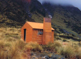 Top Tuke Hut prior to fireplace removal, probably late 1960's
Type
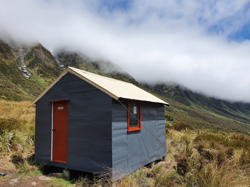
Top Tuke Hut is a standard NZFS S81, 4-bunk design built sometime around 1964. Derrick Field remembers the hut site being prepared that year. The original hut had an open fire, which would have been highly impractical given the site was open tussock with scattered low alpine scrub. The chimney was removed early on, and the Hut walls were lined at some point. There is no toilet, and water is from a small creek 20 or so metres from the door. There is some NIWA recording equipment near the Hut and choppers fly in from time to time to take readings.
Condition
DOC went in and did some maintenance on it in December 2020, replacing the roofing underlay, removing lead, replacing the clearlight on the roof, and painting the Hut exterior. The door was patched, the down-valley wall braced, some interior wall linings were replaced, and refastened the cladding where it was coming loose. In October '22 they went in and finished upgrading the tie-downs. An unprecedented influx of parties passing through to Ivory Lake in the 2021/ 22 summer season has highlighted the need for a toilet. DOC has one planned along with new windows on their deferred maintenance schedule. Currently of concern is a broken louvre pane, now completely gone from the rear window. This was probably smashed/pushed out by the mattress on the top bunk, the end of which juts against the window. The rear of the hut is now open to the weather through the gap.
Routes
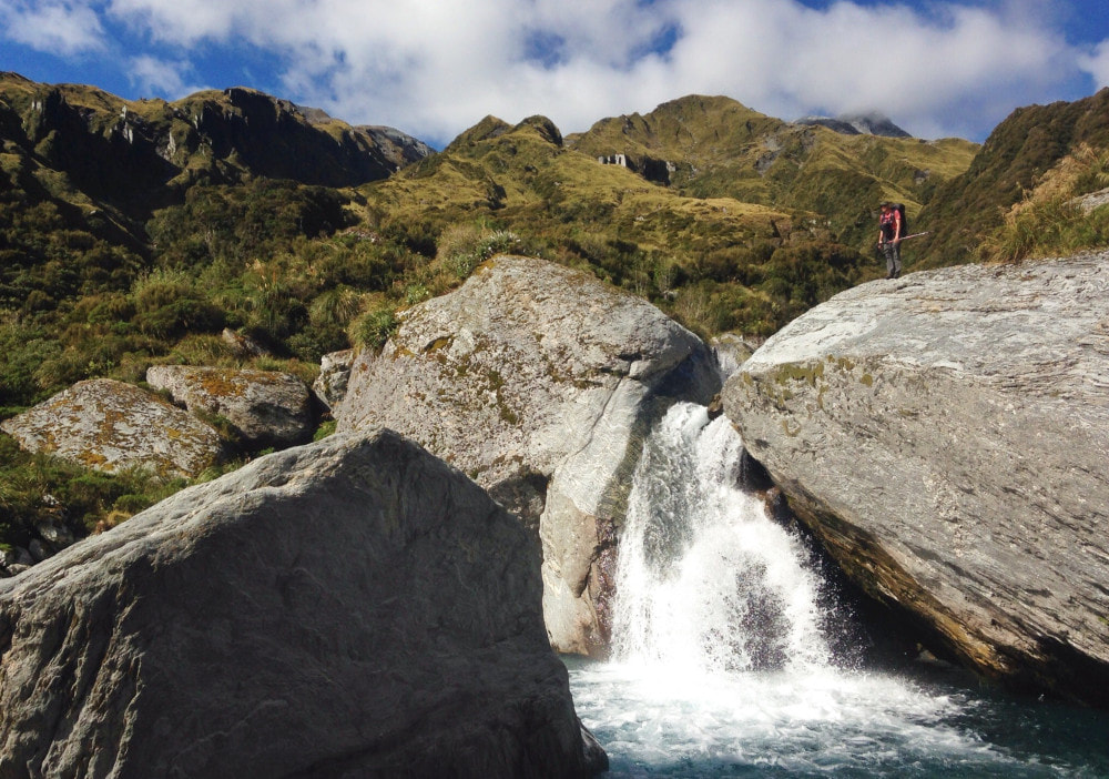
Ivory Lake Hut can be accessed from the head of the Tuke basin. Ease of travel in the upper Tuke is dependent on your ability to negotiate large boulders fringed by alpine scrub. There are some delightful pools on this section for those summer dips. Follow the upper TL fork of the river which has three branches that drain The Tusk and Sawtooth Ridge. Take the SE branch, exiting it on the TR at 1300m onto a flat bench on the broad spur that drops in a NW direction from the junction of Sawtooth Ridge and the SW ridge of Mt. Beaumont. Follow the spur up to the junction and continue towards point 2084m. There is a short, down-climb of around five metres just before point 2084m which is exposed and crumbly when snow-free and would be problematic for some without a rope. It is likely to be icy when snow covered. From here on it is reasonably straightforward, although a couple of bits on the lee side of points 2084m and 1870m might require crampons and a rope during the colder months if conditions were icy. From point 1870m, drop down the ridge on the TR of Ivory Lake, over point 1620m to the Hut. Travel times from Top Tuke to Ivory Lake in as noted in the hut book vary considerably from six to 10 hours. An alternative and slightly longer route is via Mt. Beaumont up the spur on the TL of the big unnamed side-creek just up from Top Tuke Hut. There are a few poles leading up the spur to get you started.
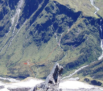 Tops access from Top Tuke Hut
There looks to be a good route from the upper Tuke basin to Top Waitaha Hut over The Tusk and Ragged Peak. It is the same initially as the Ivory lake crossing, but instead of taking the SE branch of the upper TL fork of the Tuke, take the middle branch. This turns into a dry gut with large boulders that veers West further up. it provides access to the crest of the range at the start of Sawtooth Ridge. Sidle from here around the snowfield on the the SW side of The Tusk and onto the connecting ridge to Ragged Peak. Access into the Top Waitaha basin is down the SE spur of Ragged Peak towards the Stag/ Reid Creek confluence. Drop off the ridge where it is dissected by a branch of Watson Creek around 1360m. A steepish spur drops west from the bench here down towards an unnamed side-creek that enters the Waitaha 100m downstream from the Hut. Top Waitaha Hut is visible from a number of points on the descent. Allow 4-6 for this crossing. Ice axes and crampons would be necessary at times during the colder months.
It is possible to do a traverse Galena Ridge from Top Tuke to and Healey Creek Hut. The route onto the tops behind Top Tuke is up the ridge on the TR of the large creek with waterfall. There is a small notch in the band of bluffs at the top of the ridge (around E1428665/ N5227080 (BV18 287 271)) that allows access up and into the the hanging basin above the fall. Continue up the creek to where it veers right and exit up the tussock faces onto the spur bounding the TR of the basin. There is one short, steep eroded section near the top of the spur, but nothing too radical. Travel along Galena Ridge from point 1974m to Remarkable Peak is relatively easy, and access onto Healey Spur is down a steep rib of tussock and loose rock when snow-free. There is a dip at the bottom of this, followed by a short razor-backed section that can be traversed with care, or avoided by dropping onto the tussock slopes on the Healey Creek side and sidling between the 1500 and 1600m contours. It is necessary to climb back onto the Spur either SE or NW of point 1643m due to deep slots that prevent a direct sidle down to the Hut.
Mt. Beaumont is an easy climb from the head of the Tuke. DOC poled and cut a trail through the scrub upriver from the Hut in 2007 that provides access to its leading ridge. More waratahs were placed on the ridge in 2020. From Beaumont it is possible to drop down into the Whitcombe valley via The Rotunda and Steadman Brow. The route is straightforward apart from a short steep exposed section just above the 1620m contour. This is probably OK to upclimb without protection, but it may be advisable to carry a rope for those heading down. A maintained track provides access down a side-spur that connects with Cropp Brow at a flat area just NE of Cropp Knob. The track is in excellent shape although a number of parties have had trouble locating the top entrance markers which are a bit further north than where the track is marked on the NZ Topomap. It leads down to the Price Flat swingbridge in the Whitcombe valley, taking around two hours from the scrubline.
Access into the Cropp basin is possible from point 1898m, North of Mt. Beaumont. Sidle from here to point 1695m and drop in an easterly direction down some eroding faces into the upper South branch of the Cropp River. The top of the descent is steep, but there are some reasonable lines down. A waterfall in the South Cropp at around the 1000m contour can be skirted on a rocky ledge on the TL. Down in the basin proper there are good campsites on the tussock flat on the TR opposite to where Cropp Hut used to be. The remains of the Hut were helicoptered over to this side of the river and are not far from the NIWA measuring station.
Repairs needed.
The louvre pane urgently needs replacing. I've got a stack of spare panes at home but they're of varying size. If someone passing through wants to measure the size needed, we can get one of the local chopper pilots to drop one in when they're passing by. Longer term, and as planned, DOC will be replacing the louvres with single pane windows. Increased visitor numbers also highlight the need for the planned toilet to be installed asap.
Provisions on Site
One slasher, one flat file, a broom, an aluminium wash basin, two billies, a hand broom a broken hearth shovel, a scrubbing brush, candles, a snow stake, a tent, a 10-litre plastic paint bucket, two 20 litre plastic containers and a large plastic food container.
