Price Basin Hut
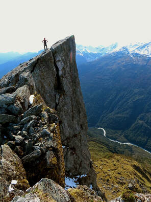
 View down into the Whitcombe from below Mt Van Redan.
Maintenance Status
Price Basin Hut is a remote and very low-use hut. It was designated as fully maintained by DOC way back in 2004, received some minimal work around that time, but none after that. Back Country Trust decided to pick it up as a maintenance project in 2022 and the overhaul which involved reroofing, painting, and minor repairs, took place in October this year.
Location
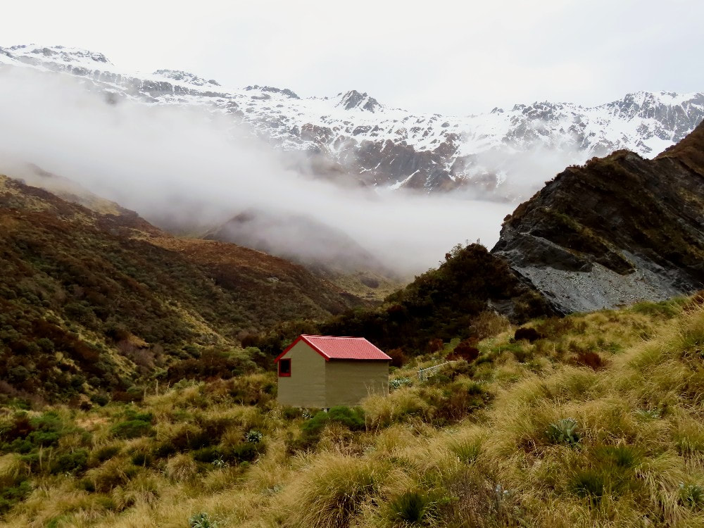
Whitcombe catchment. Map BW18. Grid Ref: E1434362/ N5222640 (BW18 344 226). Altitude 1060m. Price Basin Hut is located on a tussock rib between two side creeks in the upper TR basin of the Price River, one of the larger tributaries of the Whitcombe River. Price basin backs onto the Lange Range and Pahlow Ridge and is a spectacular and rugged setting. Below the Hut the river drops over a large waterfall and down through an impassable gorge to the Whitcombe valley. All the routes to the Hut are over the tops and are reasonably demanding, as well as being a good three-day's walk from any roadend. Foot visits are irregular, maybe two or three per year and it gets around five fly-in hunting parties per year. Rock wren can be sighted in a few spots above the Hut, and around Mt Wylde Brown.
Access
The most direct access to Price Basin is up the TR of the Whitcombe River. The valley tracks here are maintained by DOC and are usually in good condition, although there is a fair bit of active slippage between Frew Hut and Wilkinson Hut along some of the bush sidles. DOC did their last recut of the valley in 2021. There are a number of large unbridged side-creeks on the way up that would hinder travel after heavy rain. Allow two longish days to reach Wilkinson Hut from the roadend. From here head back down the TL to Pahlow Creek, the second big side creek which is marked but unnamed on the topo map. An old NZFS track down this side was partially recut by some Permolat people in 2015 and is still followable. On rare occasions when river levels are very low it may be possible to ford the Whitcombe from the TR opposite, or near Pahlow Creek, and this would save having to go all the way up to Wilkinson Hut and back down. Mostly however, this is not possible or safe. The route up Pahlow Creek and into Price basin is marked as a track on NZ Topomaps. Unfortunately, this is not the case and although LINZ have been notified, they haven't yet changed it to a dotted line indicating a route only.
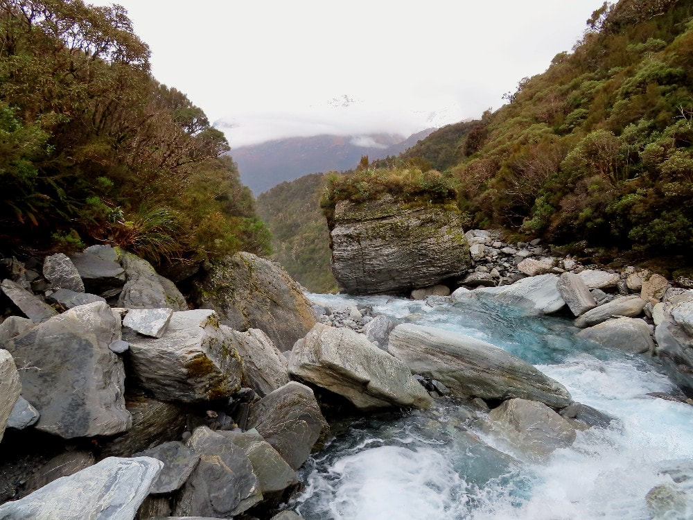
Head up Pahlow Creek taking the TL branch at each of two forks. The creek is rough and steep with large boulders and cataracts and in some places short bush detours may be necessary. Exit near the head of the Creek where it starts to get bluffy and sidle NE along a sloping tussock bench under the faces of Mt Van Redan towards Johanson Peak. There are plenty of spaniards on this section. A scree slope at around E1435862/ N5222427 (BW18 359 224) provides access up onto Pahlow Ridge, which is followed up to around the 1500m contour. From here you can start dropping into the basin using the Hut as your line of sight. The terrain going down is rough and rocky underfoot with scattered large boulders. Spaniards are prolific between the 1200 and 1100m contours. A band of scrub on the last 100 vertical meters of the descent can be avoided by heading upriver a bit and dropping down the side-creek that drains Mt Van Redan. Allow at least 8 hours from Wilkinson Hut to Price Basin Hut.
Parties intending to fly out of Prices should take in a bit of extra food. Due to frequent poor weather and the basin often being misted-in, pick-ups can be delayed several days.
Type
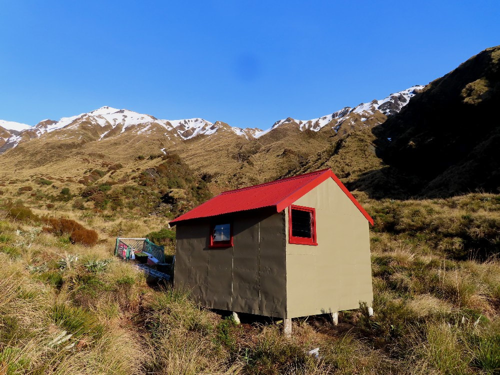
Price Basin Hut is a pretty much unmodified, NZFS S81 four-bunk design, built in 1962. It was lined with tar paper as was the standard then. Water is from the creek next to it. There is no toilet.
Condition
Price Basin Hut has survived many years of minimal maintenance in good condition with its original framing, sub-floor and piles remaining remarkably sound. DOC repainted and resealed the Hut during the Summer of 2003/4. By 2023 there was a bit of dampness around the bottom plates and floor at the front end where gravel had accumulated and pushed up against the cladding allowing a bit of water creep from winter snow. The BCT/ Permolat team comprising Clint Jarvis, Mark Williamson, myself and Joke de Rijke replaced the roof and ridging, put some ply sarking between the rafters and iron, repainted the exterior, resealed the windows, dug out the front of the hut to divert run-off, and made some door repairs.
Routes
For the more experienced types there is an alpine crossing the Lange Range from Prices Basin over to Ivory Lake Hut Access is up the side-spur that connects Mt Wylde Brown with point 2056m. This is mostly easy travel apart from a rock buttress at around 1880m that can be sidled around on its South side. This isn't normally problematic, but caution would be needed if there were hard snow or ice. From point 2056m drop directly down to the south end of Ivory Lake. The Hut is visible most of the way down in clear conditions. In late summer and autumn, the crossing is usually snow-free, apart from a small patch on point 2056m. It would be advisable to carry ice axes and crampons at other times. Allow 5-6 hours from Hut to Hut in good conditions.
A high traverse is possible from Price Basin Hut to the Cropp Basin although it is not a particularly easy route. Access from Mt Wylde Brown down into the TL branch of Price River involves a lengthy downhill scrub-bash. It may be easier to drop down the side-creek from the low point west of Wylde Brown. It looks OK from the Cropp Brow but is as yet untried. Access from the lip of the TL basin of the Price River up onto The Rotunda is up some steep faces composed of rotten, unstable rock, and extreme care is required on this bit. Once on the Cropp Brow it's very easy going and there are several routes down into the Cropp basin.
Alternately, continue down Steadman Brow to Cropp Knob. This is straightforward apart from a short steep exposed section just above the 1620m contour, which is probably OK to upclimb without protection, but it may be advisable to carry a rope for those heading down. A maintained track provides access down a side-spur that connects with Cropp Brow at a flat area just NE of Cropp Knob. The track should still be in good shape although a number of parties have had trouble locating the top entrance markers which are a bit further north than where the track is marked on the NZ Topomap. It leads down to the Price Flat swingbridge in the Whitcombe valley, taking around two hours from the scrubline.
Access from Price Basin up onto the NE ridge of Mt Thorndike is relatively easy. There are great views from Mt Thorndike over the Wilkinson Ice Lake to Mt Evans and the Bracken Snowfield.
Planned Repairs
None currently. It'll be interesting to see if the current work has dealt with the damp patches.
Provisions on Site
A wooden set, two tables, a grubber, a shovel, a spare shovel handle, a wash basin, 2 brooms, a hearth brush, 2x stainless steel plates, several billies, 3x frying pans, 1x can opener, 2x fish slices, 1x ladle, 4x perspex louvre panes, 1x potato masher. Under the hut are some odds and sods of timber and a tanalised post.


