Wilkinson Hut
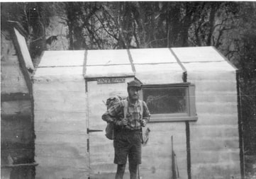 Ron Turner at Wilkinson Hut just after it was built: Photo 1957
Maintenance Status
The Department of Conservation has designated Wilkinson Hut as minimal maintenance. The main valley tracks in the Whitcombe River are fully maintained and have been recently recut. The swingbridge providing access to the Hut from the TR of the valley was overhauled in May 2019.
Location
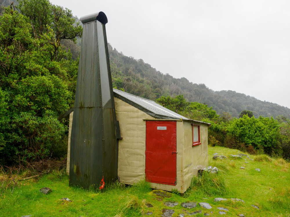
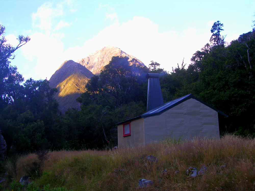
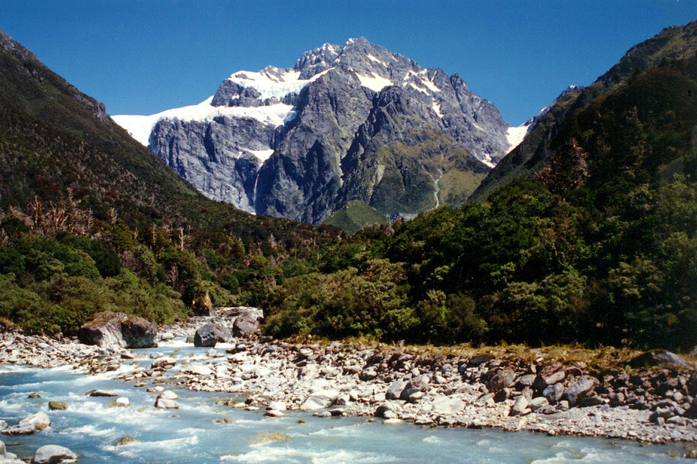
Whitcombe catchment. Map BW18. Grid Ref: E1436568/ N5219830 (BW18 366 198). Altitude 605m. Wilkinson Hut is located at the top end of a river flat on the TL of the upper Whitcombe valley. A swingbridge 10 minutes upriver provides access from the main valley track on the TR, however Wilkinson is generally bypassed by those travelling between Price Flat and Neave huts on the Whitcombe Pass circuit. Wilkinson Hut is a relic of the 1950's, pokey and dark, but cosy with the fire going (watch your forehead on the low door frame!). It sits in a clearing ringed by regenerating hardwoods. Montane forest comprising rata, kamahi, totara and broadleaf cloaks the hillsides above. Hut users are a mix of fly-in hunters, those walking the Whitcombe Pass circuit, and occasional groups heading into the more rugged Price or Wilkinson catchments. In decades past it wasn't uncommon for the odd hardy possumer to overwinter there.
Access
Wilkinson Hut can be accessed in around the same time from both sides of the Alps. The tracks and huts on the TR of the Whitcombe valley tracks are fully maintained by the Department of Conservation and the huts are in good condition currently. Some sections between Frew and Price Flat are unstable and actively slipping into the river, taking bits of track with them. The worst bits are upstream of Cat Creek and a recent party had to climb to 400m to circumvent them. It currently takes around 3.5-4 hours to get up to Wilkinson Hut from Price Flat Hut, or two days from the Hokitika roadend. Access from Canterbury side over Whitcombe Pass also takes two days and involves a crossing of the Rakaia River, which can be treacherous after rain. The Pass itself usually straightforward, although occasional deep snow in Winter can slow the crossing considerably. The last section from Neave Hut down to Wilkinson Hut takes around 1.5 hours.
Type
Wilkinson Hut was one of a unique batch of four B48 designs built in Westland in 1957 by the New Zealand Forest Service. It was erected during the winter by Ron Turner and Bill Radumski. The B48 was a forerunner of the S81 design that later became the standard around the country. Its layout was strongly influenced by the Department of Internal Affairs huts built in the area earlier in the decade. The materials for the Hut were dropped in by fixed-wing aircraft and some of the timber framing was damaged on impact. Ron fashioned an adze from an old mattock and squared totara poles to replace the damaged bits and make the bunk uprights. NZFS later added a porch and replaced the flat iron roof with corrugated iron. Wilkinson still has its open fire and is lined with the original tar paper under chicken wire. There is a toilet. Water is from the river.
Condition
Wilkinson should be in pretty good condition currently. DOC painted and resealed it, replaced some of the piles and benchtop, and did some floor and chimney repairs during the summer of 2003/ 4. A split clearlite sheet was replaced in 2014. In May 2024 DOC re-roofed the hut and added sarking under the iron, replaced rotting framing and floorboards and painted the exterior. Rats had been getting into the hut prior to that so it will be interesting to see if the repairs keep them out.
Routes
Price Basin Hut can be accessed by heading back down the TL of the Whitcombe to Pahlow Creek, the second big side creek which is marked but unnamed on the topo map. An old NZFS track down this side was partially recut by some Permolat people in 2015 and is still followable. The route up Pahlow Creek and into Price basin is marked as a track on NZ Topomaps. Unfortunately, this is not the case and I've contacted LINZ and asked to have this made into a dotted line indicating a route only.
Head up Pahlow Creek taking the TL branch at each of two forks. The creek is rough and steep with large boulders and cataracts and in some places short bush detours may be necessary. Exit near the head of the Creek where it starts to get bluffy and sidle NE along a sloping tussock bench under the faces of Mt Van Redan towards Johanson Peak. There are plenty of spaniards on this section. A scree slope at around E1435862/ N5222427 (BW18 359 224) provides access up onto Pahlow Ridge, which is followed up to around the 1500m contour. From here you can start dropping into the basin using the Hut as your line of sight. The terrain going down is rough and rocky underfoot with scattered large boulders. A band of scrub on the last 100m before the river can be avoided by heading upriver a bit and dropping down the side-creek that drains Mt. Van Redan. Allow at least 8 hours from Wilkinson Hut to Price Basin Hut.
The Wilkinson River can be accessed up the TL of the Whitcombe valley from Wilkinson Hut. An hour's boulderhopping will get you to the junction, with a few short detours into the bush to skirt bluffs and boulders. The Wilkinson is rough, swift, opaque, glacial meltwater, and its boulders are very slippery. It is usually more difficult to ford in summer when its levels rise over the day due to ice melt. The lower valley is bouldery with dense scrub often to the water's edge and travel is easier away from the river a bit, along the TR terraces. Finding a good deer trail will aid progress through the thicker patches of montane forest.
There is a steep bouldery cascade above Walcott Creek fringed by dense alpine scrub, and there is no easy way around this. Seddon Creek comes in above the cascade and is swift flowing. Ford with care and cross back into the Wilkinson over the a low scrub covered ridge on the TR of the Seddon. The last stretch of the Wilkinson to the ice lake is reasonably level, easy travel and the river can be crossed and re-crossed without too much trouble.
We have no recent accounts of travel up TR of the Wilkinson. The late Austen Deans in his book Capturing Mountains counsels against following the riverbed and advises heading into the bush and following the deer trails. Maybe this is still the case.
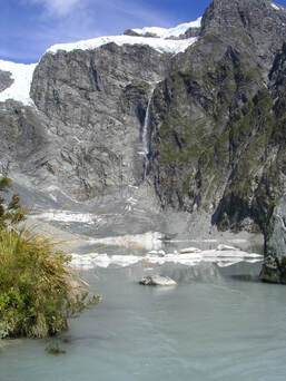 Wilkinson ice lake looking up to the rock buttresses of Mt. Evans
The ice lake at the head of the Wilkinson is a stunning spot. A serene mirror reflecting the huge and daunting rock buttresses of Mt Evans. Small icebergs drift up and down the lake with the prevailing breezes and the stillness is punctuated by the regular crackle and roar of pieces breaking off the Bracken ice shelf and avalanching over the sheer rock bluffs.
A low saddle behind Agfa Knob provides easy access from the ice lake over into Seddon Creek. A large boulder cascade just upstream is rough going, and easier to skirt on the TL. A rather tricky ford near the top of the cascade will get you back over to the TR and the Bevernage Rock Bivs. A short scrub-bash is needed to get up to a couple of disappointing small, shallow overhangs that are hardly worth marking on the map. The largest would take two people at a squeeze. If you are considering spending a night or two in the Wilkinson, try kipping out under a gigantic and clearly visible boulder 15 minutes up Walcott Creek.
Above the Bevernage Bivs the Seddon becomes much easier going and provides access to Seddon and McKenzie cols. The approach to Seddon Col is up well graded v-chute which ascends all the way from the upper snowfield onto a band of smooth, glacial-carved schist due East of the Col. In the colder months the chute would be filled with snow, providing easy travel, whilst in late summer/ autumn it would be a fairly easy rock scramble, possibly slippery if wet.
The western side of Seddon Col is straightforward loose scree/rocks all the way down into Stag Creek. Stag Creek needs to be exited around the 1460m contour and the TR faces sidled from here to Ivory Lake Hut. There are a couple of exposed bits on this side and people may prefer to sidle along some easier tussock benches on the TL, drop back into Stag Creek where it flattens out, and climb up to the Hut from there.
The creek draining McKenzie Col turns into a dry rock gut a short distance above its confluence with Seddon Creek and is filled with avalanche debris from here on. Travel is straightforward up to the col, but there is a very high and constant rockfall danger. The County side of the Col is a near-vertical rock chute that doesn't look particularly nice.
Allow eight hours for a return day trip from Wilkinson Hut to the ice lake, or five hours one-way with a full pack.
Repairs needed.
Shouldn't be any currently.
Provisions on site
A bow saw, a very blunt axe, two hearth shovels, a broom, an adze, a hearth brush, a shovel, a small camp oven, a billy (no lid), and a small pot. There is a roll of wire rope under the Hut.
