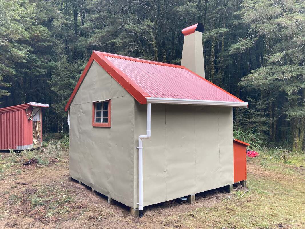
JOHNSON HUT

 Campsite above Kiwi Saddle
Maintenance Status
Johnson hut is included in the general maintenance agreement Permolat has with Department of Conservation for a number of remote huts and tracks in Westland. The Johnson valley is zoned as "remote experience," meaning existing facilities may be maintained, but not necessarily replaced. The access tracks haven't been "officially" maintained for many years. In the autumn of 2015 Jason Campbell and Mayer Levy of Permolat, and Bruce Polkinghorn, went in did some initial repairs, painting, and scrub clearance around the Hut. In 2022 the Back Country Trust used some Kaimahi for Nature funds to do some more maintenance and site clearance. In the winter of 2023 Andrew Barker started work on reopening the route to the Hut from the Little Wanganui valley. In December he organised a team to fly into Kiwi Saddle cut and mark the route from the Little Wanganui to just below Little Fugel Creek in the Johnson. The fly-in was funded by way of a BCT grant obtained by the Permolat Group. Andrew went back into the valley in March to augment the trackwork that had already been done.
Location
Mokihinui catchment. Map BQ22. Grid Ref: E1539566/ N5409093 (BQ22 396 091). Altitude 392m. Johnson Hut is situated on the TR of the Johnson River, 1.7 km above its confluence with the North Branch of the Mokihinui River. The Hut is 70m further West from the River than marked on the topo map in a small clearing surrounded by scattered regenerating silver beech which merges with taller forest North of the Hut. Johnson Hut gets around five fly-in parties and two walk-ins per year. The fly-ins are mainly for trout fishing, and the rest for deer, or goat hunting. The Hut is in a site that does not get much sun in winter.
Access
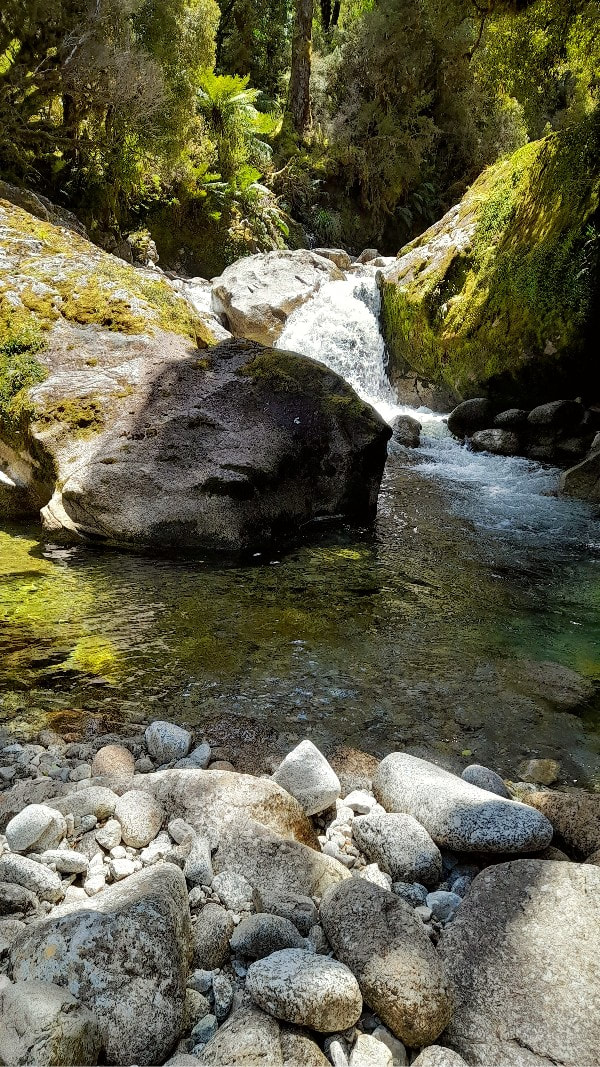
The Johnson River lies on a historic mining/ prospecting route that linked the Wangapeka and Lyell pack tracks. The original blazed tracks were severely damaged by the 1929 earthquake and never repaired to their original standard. By 1979 the track from the Little Wanganui River over Kiwi Saddle had become overgrown. After that there was only the odd bit of minimal marking and cutting done by various individuals over the years. The track that is marked on current Topo maps is not an accurate representation of the actual line and downstream of Little Fugel Creek there is little of the original track remaining. Fortunately, from there on, travel is generally easy through open beech forest or along the riverbed.
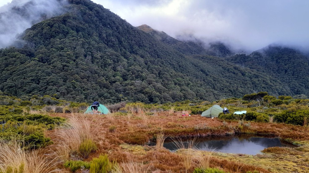
The NZ Topomap has the Kiwi Saddle track starting on the TL of the Little Wanganui just above Piano Creek however the actual start is now 20m up the TL of Kiwi Creek. There is an initial steep climb up a shingle face onto the bush terrace above. From here the track sidles around into Kiwi Creek and follows up its TL, crossing to the TR on the last steep section below Kiwi Saddle. It drops from here down into Silver Creek and follows its TL down to the Johnson. The track follows the TR of the Johnson skirting a small gorge and waterfall to Fugel Creek. Following this there is a section of river travel in which several fords are necessary to maintain a line. The river here is easy to cross and recross at normal flows. The track re-enters the bush at the top entrance of a second gorge (E1537376/ N5415904) which it skirts before dropping back to the river. A mix of river travel and short bits of track follows to the top end of a third gorge (E1537212/ N5415215). A final tracked section takes you down to just below Little Fugal Creek where the river flattens and opens out. The route from here is a mix of river and bush travel. There is a swampy section between Little Fugel and Deep Creek but otherwise the going is pretty easy. In March Andrew cut and flagged most of a 1.5km section of track that starts 500m upriver from the hut. A sign on the riverbed marks the final bit of track up to the hut that crosses a grassy clearing on the way. Allow two days from the Little Wanganui roadend to Johnson Hut; 2.5 hours from the roadend to Bell Town-Mananui Hut, 4-5 hours from here to Kiwi Saddle, 2 hours to Little Fugel Creek, and 3-4 for the remainder to Johnson Hut. A good way to break up the trip is to camp out on an open peaty clearing with tarns five minutes above Kiwi Saddle. An old trail that went to some mine workings in the head of Silver Creek turns off at the Kiwi Saddle sign.
There is a helipad East of the hut on the grassy clearing near the river.
 Johnson Hut interior - Plenty of history.
Type
Johnson Hut is an unlined four-bunker with an open fire built in 1957 by the NZFS Nelson Conservancy. The materials were air-dropped by a Beaver plane. The Hut predates the S81 design that later became the standard and there were only small number of this type built. The only other remaining example is Kakapo Hut in the Karamea catchment. Johnson's four-pane windows were replaced in the 2015 maintenance. The Hut also had a skylight retrofitted at some stage. Its interior is plastered with visitor names dating back to 1967.
Condition
In 2015 Jason and his crew painted the Hut exterior, installed pane glass windows, and did some fireplace repairs. In 2022 Tim Marshall's team which included Ollie Clifton from BCT did some more fireplace repairs, re-roofed the hut, built a new woodshed, rebuilt the front door and repaired the outside of the chimney. They also installed some drainage and cleared back the vegetation around the Hut, In March Andrew noted that the chimney drips a lot of water onto the fire when it rains. Fortunately, it's not running into the hut though, instead it drains away thru the hearth stones. The hut could also do with a door latch on the inside. At the moment there is a counterweight of wood and string holding it closed. The fire smokes when it is going, and the door needs to be open an inch to draw, as the windows don't open. There is a wasp nest in the woodshed.
 The Johnson River downstream from the Hut looking back upriver. Photo Glenn Johnston
Routes
Johnson Hut can be accessed from Mokihinui roadend via the Mokihinui and Hemphill rivers and Johnson Ridge. This is an untracked route which takes around three days. Day one takes you to the Mokihinui Forks and a second fairly long day to Lake Phyllis or Marina. From The lakes it is around seven hours up and over Johnson Ridge to the Hut. According to Dave Pratt, anyone attempting this route should have a fondness for subalpine scrub, but adds that the Hemphill River is a joy, with a feeling of remoteness second to none.
Johnson Hut can also be accessed via the North Branch of the Mokihinui, a difficult route that can only be done when River flows are very low. Numerous crossings are required in the gorge, including a two-jump crossing using a rock in the middle of a deep channel that could be difficult with a heavy pack.
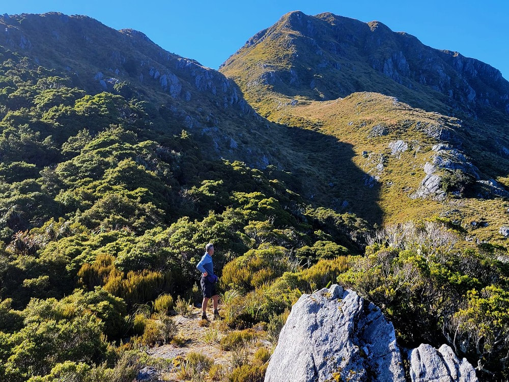 Mt Zetland from the 1200m contour - Photo Matt Barker
In Autumn 2024 Andrew Barker recut two old routes above Kiwi Saddle, the first to an old mine site in the head of Silver Creek. This passes an open area with tarns 10 minutes above the Saddle which is an ideal camp spot. Mt Radiant can be accessed by continuing up Silver Creek and the Radiant tops are good going. There are a lot of relics around the mine site that should excite the history buffs.
The other route is onto Mt Zetland via the prominent ridge leading up from the Saddle. The top end of the track has two entrances, one on the main spur, and the other at a shallow tarn on the bushline. The Zetland tops provide good travel around to Little Wanganui Saddle with great camping spots in Zetland basin. There is cellphone reception from both Mt Radiant and Zetland.
Repairs needed.
An interior door latch could be fitted and possibly a chimney cowling to keep the rain out. The wasp nest in the woodshed needs dealing to.
Provisions On Site
Four mattresses, two aluminium basins, a plastic bucket, a broom, a hearth brush and shovel, a small hand saw, an axe, a billy, a frypan, a small paint brush, and a quantity of paint.
