Nardoo Biv
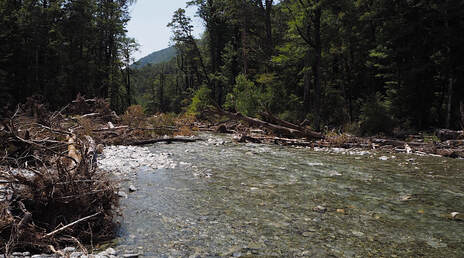 Flood damage in the lower Nardoo: Photo Graeme Coop
Maintenance status
Nardoo is a high-stud bivouac but is named as hut on all the maps and other info sites. Department of Conservation have been doing low-level maintenance on it over the years and in autumn 2022 teamed up with Back Country Trust to give it a decent makeover. Not sure about the current maintenance status of the access tracks but DOC appears to still have an interest in their upkeep.
Location
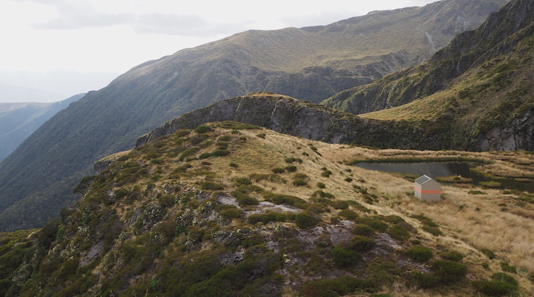
Matakitaki river catchment. NZTopo50 map sheet: BS23, Grid/NZTM2000 coordinates: E1552820, N5339336, altitude 1405m. Located in a spectacular alpine basin on the Emily Peaks range in the south-west corner of Nelson Lakes National Park.
Access
River access up Nardoo Creek had become increasingly gnarly over the years, however a combined Jobs for Nature/DOC track team got some work done re-cutting and marking the route at the same time the biv maintenance was happening. DOC also intends opening up a new section of track down the spur from Nardoo Peak in order to establish a more viable tops option. Some parties are opting to use this high route anyway and are accessing the tops up a leading spur through moderately steep beech forest from lower down Nardoo Creek.
For those choosing the Creek route, an old 4WD track that goes up the TL of the Matakitaki River and over a low saddle between points 580m and 590m into the Nardoo is used. From this point it is generally better to follow the riverbed. The original trackline has been washed in a lot of places, and crossing and re-crossing the creek to skirt the bluffs and windfall is the better option, using the marked track when found. The track from the end of the top flat through the forested section is now cut and marked although whoever did the job didn't cut the regen at ground level and the many spikes sticking up are a trip hazard. There are poles from the bushline to the Hut which look as if they've been supplemented in recent times. Allow around eight hours from the Ella Station DOC carpark up to the Biv.
Being sited in Nelson Lakes has meant that helicopter access to Nardoo Biv was up until very recently prohibited, however rising deer numbers have led to a change in policy. DOC is now allowing managed fly-in parties to land within Park boundaries for hunting purposes.
Type
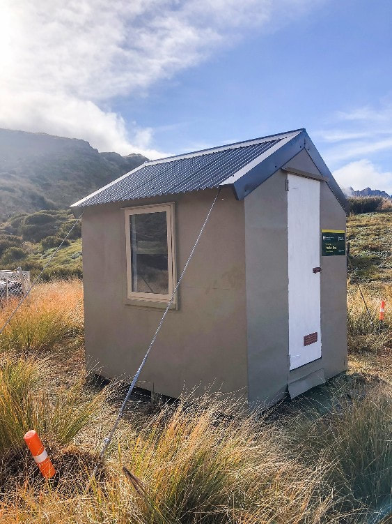
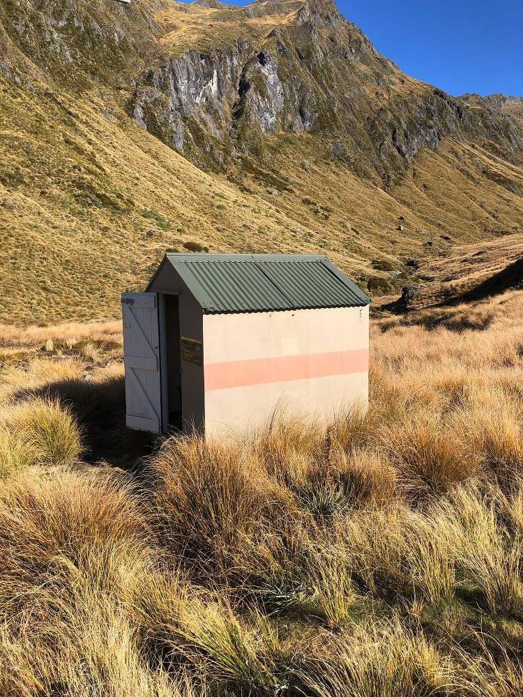
Nardoo Biv is an NZFS S86 design built in November 1965. It is lined, with two bunks (with mattresses) and a single louvre window. Water is from the tarn next to the Biv or the creek. Des Mills was one of three guys who built Nardoo and he's said he'll provide some photos and history at some point.
Condition
Nardoo Biv will have been minimally maintained since DOC took over the tenure but it seems to have held out well. In May 22 a team led by Tim Marshall went in and re-roofed the Biv as part of the continuing programme to remove lead from the backcountry. A new window was put in to replace the old leaking louvre and for the first time ever the biv got some tie-downs. A thunderbox toiled was also installed.
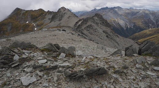 Emily Peaks from Point 2024: Photo Graeme Coop
Routes
There is a high-level circuit for the fit and experienced that incorporates Nardoo Biv, Burn Creek Hut, Burn Creek and the Matakitaki, and takes four days. Access from the Biv onto the crest of the range is possible directly up through some steep country to point 1786m. A gentler but longer approach can be made from the head of the basin to the saddle SE of point 1840m. The crest of the range is then followed to the saddle between points 2024m and 1952m. The option here is to either drop down directly into the top basin of Burn Creek or continue along the range to just past point 1952m and drop directly down its SE spur to the Hut. The creek option involves a scramble around a 15m waterfall on its TL. This route is also more avalanche prone in the colder months and like the rest of the traverse is an alpine crossing and like the high route from Nardoo Peak it necessitates the carrying of appropriate snow gear depending on the season and conditions. In late summer and autumn when snow-free it is a more straightforward affair, although still prone to the usual alpine weather extremes. Allow 6-10 hours for the crossing.
Nardoo Biv can also be accessed along the tops from Nardoo (1449m). There is an old permolatted track which can be found on NZTM Topo 2009 on the Maps Past website that provides access to the bushline from the lower end of Nardoo Creek. It starts on the TR of an unnamed side-creek that enters the Nardoo at E1557368/ N 5344300. If descending from the trig, there are bits of the track with lots of permolat and other bits where none is evident, and the track easy to lose. As long as you stay close to the edge of the prominent slip on the TR of the ridge the trail is re-findable. It is very steep at the bottom end.
A NE outlier of Nardoo tops can be traversed from Nardoo basin. There are a couple of tracks marked on the NZTM Topo 2009 leading up to Pt 1380m. The first is from the Nardoo valley up the TL of an unnamed side-creek starting at E1556122/ N5539907 and the second on the TL of the first side-creek of Junction Creek in the Matakitaki, starting at E1559089/ N5338353. A 2023 party was unsuccessful in finding any permolat when attempting to locate and follow the route down into the Matakitaki. A GPS descent was required but was relatively easy.
Repairs needed.
None hopefully. The track up onto Mt Nardoo would be worth fixing up.
Provisions on site
A small wooden bench seat and an aluminium bucket.
