Yeats Ridge Hut
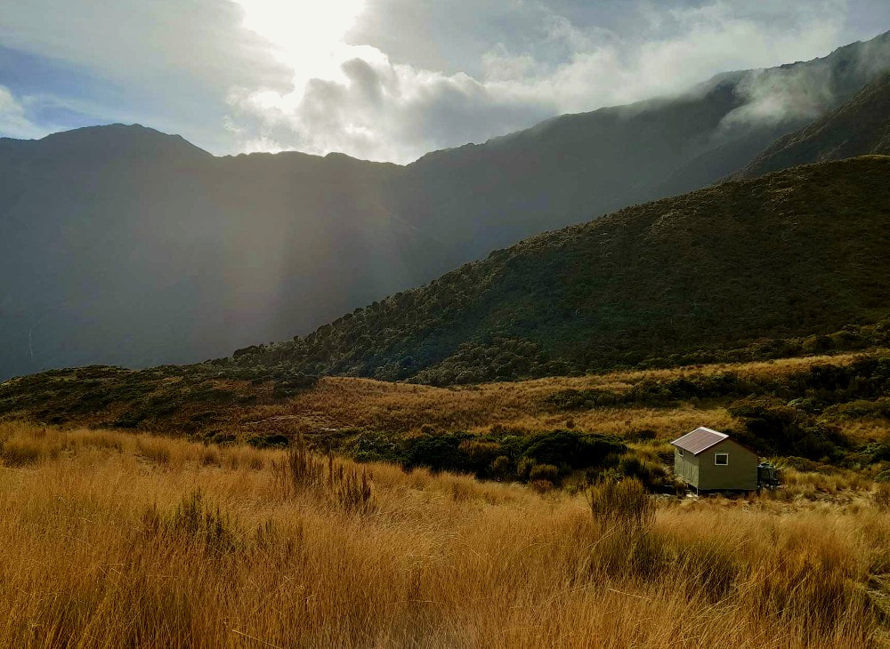
 Looking down the Toaroha from the tops above Yeats Ridge.
Maintenance Status
Permolat started taking an interest in Yeats Ridge Hut after the Department of Conservation designated it as minimal maintenance in 2004. The track up to it from the Toaroha valley has also been volunteer maintained since around that time. Liz Wightwick and her Canterbury friends have taken a lead role in recent times. In 2014 a water tank was installed as part of a Permolat/ DOC collaboration and in 2016 Paul Reid of Permolat received some High-Country Consortium (pre-Back Country Trust) funding and did some additional maintenance. In February 2024 BCT carpenters assisted by members of the Peninsula Tramping Club completed some outstanding work that badly needed doing. The project was made possible by a bequeath from the late Leo Maunders, a PCT member and keen remote tramper. BCT generously agreed to match the bequest amount. Liz is arranging to fly in a group in September to finish the internal and external painting.
Location
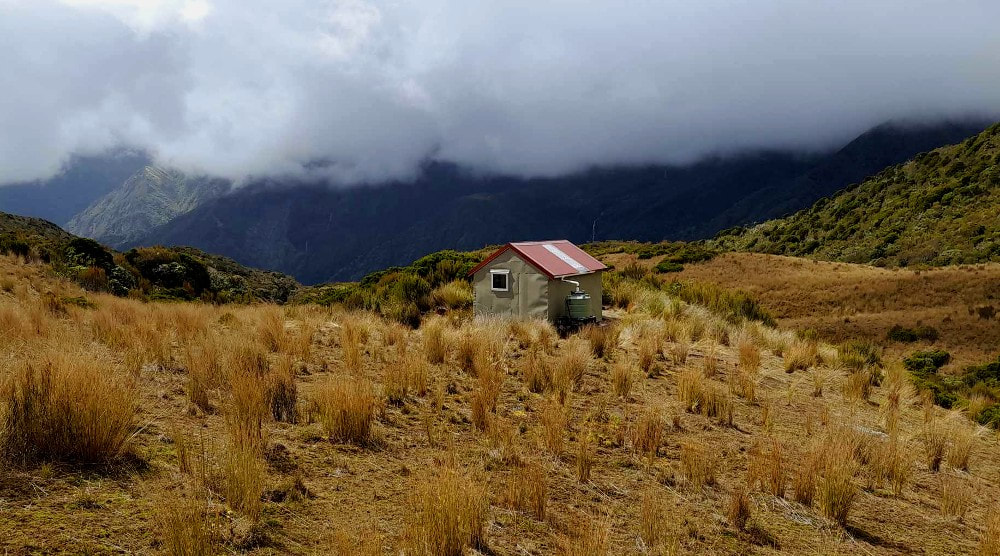
Toaroha catchment. Map BV19. Grid Ref: E1449075/ N5239244 (BV19 491 392). Altitude 970m. Yeats Ridge Hut is located on a flat section of ridge dividing the Zit Creek and Toaroha catchments. The surrounds are alpine peat bog with scattered scrub and open patches of tussock with views out over the Toaroha valley. Yeats can be done as an overnighter from the Toaroha roadend, or day trip from Cedar Flat Hut down in the main valley. Access from Yeats onto the Toaroha Range is relatively straightforward and there are good tops routes to a number of other remote huts and bivs in the area. Visits have increased markedly since Covid going from a 20 to average 33 recorded visits per year. with growing interest in the longer alpine circuits, particularly a loop incorporating Crystal Biv.
Access
The Yeats Ridge track turns off from the Top Toaroha track on the TL of Zit Creek, 30 minutes up the from Cedar Flat Hut. Zit Creek can be difficult or uncrossable after heavy rain. The track climbs from the turnoff onto a terrace, follows this briefly, then climbs again steeply up the lower bush faces of Yeats Ridge. It flattens briefly in the montane zone, then climbs again through the sub-alpine zone to a flat bench at 940m with open tussock patches and tarns. This is followed for just under a kilometre, to a low scrubby rib that is crossed to reach the Hut. The open sections are marked by wooden stakes and permolat. The track was trimmed by Liz's tramping club friends in 2021 and again in May '24. It should be in reasonably good nick at the moment. She's planning do a chainsaw run to get rid of some of the bigger windthrow as part of the up-and-coming September work. Allow 2-2.5 hours to Yeats Hut from Cedar Flat Hut, or 6-7 hours from the Toaroha roadend.
Type
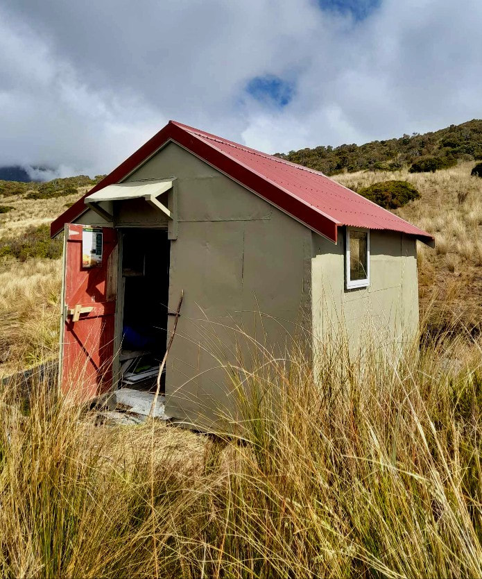
Yeats is a New Zealand Forest Service S81 four-bunk design built in 1960. Bill Johnson helped with the building. The cupboard alcoves were removed at some point to create more space, and the bunks realigned along one wall. Yeats has no fireplace, woodburner, or toilet, and is unlined. A water tank was installed by Permolat volunteers in January 2014.
Condition
Yeats Ridge Hut blew off of its piles in the early 1980's and lay on its side until righted and repaired by the NZFS in 1984. It was painted and resealed by DOC in 2004. In 2014 the Hut was repainted by Permolat volunteers when they installed the water tank. They also secured some of the framing and iron cladding. DOC supplied the paint, the water tank and stand, and flew the materials to the Hut and Permolat funded the remaining materials. In 2016 Paul and friends installed a door flashing and a new doorstep, took in a new mattress, and surveyed a site for a toilet. The BCT/ PTC project comprised a new roof and windows, re-piling and initial painting. Some rotten rafters and top plates were replaced as well. The maintenance team were assisted by DOC Hokitika staff.
Routes
The Toaroha Range tops can be accessed from Yeats Hut up the prominent spur that divides the Zit and Crystal Creek catchments. The spur forks at the 1300m contour and the SW fork can be used to access Crystal Biv. The spur is accessed across the basin below the Hut. Small wooden snow stakes are followed through patchy scrub to a low ridge bounding Zit Creek. A trail leads South along this to a broad face at the foot of the main spur. Permolat, then the odd warratah, mark a trail up through a band of alpine scrub to a flat bench with tarns at 1300m. A side-spur that drops off in a SW direction provides access down to Crystal Biv. It is open easy travel down to the Biv which is visible in fine weather from around the 1200m mark. A band of scattered scrub above the Biv can be negotiated by veering North around the big tarn. Allow 1.5 hours to get from Yeats Hut to Crystal Biv.
Top Kokatahi Hut can be accessed by continuing up the main spur onto Toaroha Range. A short bluffy section of ridge around 1400m can be avoided by sidling on the Zit Creek side. Head North along the crest of the Range to around E1451479/ N5239437 (BV19 515 394) and drop down the tussock faces into the head of the Kokatahi River. Boulderhop from here down to the Hut. Ice axes may be necessary on some of the steeper bits on the Kokatahi side during the colder months. Allow four hours for the crossing in good conditions.
Adventure Biv can be accessed from Yeats Hut by continuing North along the Toaroha Range. There is a narrow section of ridge just before Zit Saddle that needs to be sidled on the Kokatahi side. The slopes are steep here and care is required in wet or icy conditions. Recently, and with the increased popularity of this traverse, a few parties have found this bit too exposed for comfort. It shouldn't be a problem for those confident with heights but take a rope if you are unsure. Continue from the Saddle to where the poled route from Top Kokatahi Hut crosses over. The route is incorrectly drawn on NZ topomaps, crosses over higher than marked, and drops into Toaroha down the spur due north of the one indicated (see the Adventure Biv page). The poles take you down a steep tussock face then down a narrow rib. This is followed by a short section of track through a band of scrub into the upper TR branch of Zit Creek. The route exits the TR of the Creek and sidles across a face with patchy alpine scrub onto Adventure Ridge. There is short section of cut track down the Ridge through the alpine scrub to the Biv. Don't try dropping down into Zit Creek directly from Zit Saddle unless you have a rope and a spare day up your sleeve. Allow five hours for the trip from Yeats Hut around to Adventure Biv. Ice axes should be carried for back-up during the colder months.
Mungo Hut can be accessed by heading South from point 1694m along to Mt Chamberlain. A short vertical pitch just South of Chamberlin can be avoided by sidling around some rock benches just below the summit on the Park Stream side. Access into Park Stream is down steep scree from the low point between Mt Chamberlain and Bannatyne. The top section of the gut is actively eroding, is snow-filled for most of the year, and often icy near the top. An ice axe and crampons should be carried during the colder months for this bit. Travel down the Park is straightforward to the start of a track on the TL near where the Stream veers SW. This enters the bush and climbs steeply for 5-10 minutes up to Mungo Hut. It was recut in 2012 by volunteers. Allow six hours from Yeats Hut to Mungo Hut in good conditions.
Repairs Planned
Aside from the painting that still needs to be completed it will be interesting to see whether the recent maintenance has dealt with water blowing in under the door. This had been an ongoing issue. A toilet has become a necessity also, given Yeats' increasing level of use and the fragility of the surrounding peatland.
Provisions on Site
A shovel, a broken spade, a hearth shovel and broom, a full-sized broom, a hand basin, a camp oven minus lid, and a small billy. A bench seat, a 20-litre water bucket, a bucket of tools (hammer, hacksaw blade, sealer and gun), some downpipe, paint, sugar soap, brushes, sandpaper, lengths of 4x2, various nails and screws and some permolat.


