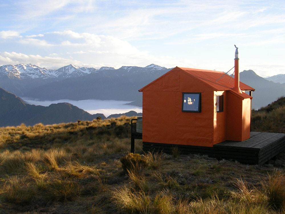
Mt Brown Hut

 The old Lower Arahura Hut before its transformation - Photo Andrew Buglass
Location
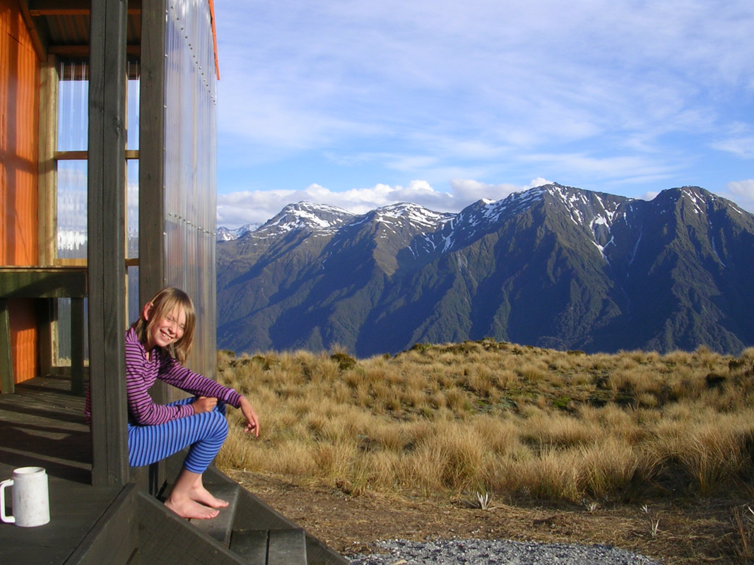
Styx catchment. Map BV19. Grid Ref: E1452950/ N5252150 (BV19 530 522). Altitude 1120m. Mt Brown Hut is located above the bushline on the West ridge of Mt Brown, which is an outlier of the Newton Range. Access up to it is straightforward in most weather and on clear days there are fabulous views of the Southern Alps, Lake Kaniere, and the coastal plain.
Maintenance Status
Mt Brown is a community-maintained hut which owes its existence to Eddie Newman and Julia Bradshaw who were living in Hokitika in 2010. The Hut was originally sited in the lower Arahura valley where it spent its first 50 years. It was a standard NZFS 4-bunk S81 design, built in 1962 and when the Department of Conservation decided to build a new Hut at the site Eddie and Julia got them to fly the dismantled sections of the old hut out to be reassembled and flown up onto Mt Brown. The project ended up becoming a total rebuild due to the numerous building code and safety requirements that didn't exist in the 1960s. Considerable community input, volunteer labour and donations made it possible for the project to reach fruition. The Permolat Group contributed financially and with volunteer input and the Hut was opened for public use in November 2010. It was an instant success, debuting in Wilderness Magazine, outdoor calendars, DOC posters, and the cover of "Shelter From The Storm," a book on high-country huts by Rob Brown, Geoff Spearpoint and Shaun Barnett. The Hut is now profiled on local tourist brochures and i-sites and in the warmer months the majority of visitors are foreign tourists or travellers.
In 2017 Eddie and Julia emigrated to Christchurch and delegated oversight of Mt Brown to the Permolat Trust which administers the koha which are used for its maintenance. With only four bunks the Hut is often not able to house the large numbers turning up, so YOU ARE STRONGLY ADVISED TO CARRY A TENT if you are heading up there during the warmer months, weekends, and public holidays. There had been 800 visits by late November 2023, 600 of which were overnighters. The long drop toilet system isn’t an ideal one for high use and we are onto our third toilet hole. Parts of the track are deteriorating, and flying coal up for the stove was stopped a couple of years back because it was being used up at an unrealistic rate. Although not in the original vision, the Hut has effectively become a high-use facility and would probably be better served by DOC administering or servicing it. Another option is for the Back Country Trust to take over management and it be put on the DOC booking system. Discussions are taking place along these lines but in the meantime is still a first come, first serve facility.
As long as Mt Brown remains a community-maintained hut it will be reliant on koha for its upkeep. Sadly, only a minority are contributing. The 600 logged overnight visits by November '23 generated a paltry $600 in koha. Considering that most of the entries are for two or more people, that averages out to be less than 50c per person. On top of that, significant numbers aren't even logging their visit in the hutbook. Really sad. Please don't be a freeloader. Koha are payable to Permolat Trust, Kiwibank, 38-9016-0266330-00. Our Charities Registration No. is CC50626. Please specify that the money is for Mt Brown so we can earmark it for that purpose.
You can also visit the Hut at Facebook and Flickr.
Access
There are two routes up onto Mt Brown giving the option of an overnight loop for those interested. The most direct and frequently used is from Geologist Creek on the Dorothy Falls Road that goes around the back of Lake Kaniere. The track starts on the South side of the Geologist Creek Bridge where it enters the bush and climbs gently initially through hardwood forest to a small creek. This is crossed and followed up parallel for a bit. The trail then veers South and climbs very steeply up the bush faces onto the SW spur of Mt Brown. The gradient eases in the sub-alpine zone and the track continues in a series of steps through the scrub to the open tussock. The route is poled from the scrubline to the Hut. The bottom section of the track has a bit of windthrow and some boggy patches that can be skirted fairly. There is a bit of regeneration and more boggy patches in places from here on. Glenn Johnston has been doing regular bits of work on the track and he and John Hutt did some windthrow clearance in 2023. John Roper-Lindsay did some re-marking work in November 2023. Allow 3-4 hours from the start of the track to the Hut depending on fitness.
The other approach to the Hut is from the Styx valley and starts at the large unnamed side-creek known locally as Mt Brown Creek. Access up the Styx valley is along a rough farm trail that turns off the Dorothy Falls Road at sharp bend 400m North of the Mark Wallace Bridge. The trail leads through some marginal paddocks for 1.5 kilometres to the Styx riverbed which is followed for a couple of hundred metres under some large shingle bluffs. These can currently be waded around at normal flows but could be difficult or impossible if the river was up. Mt Brown Creek is five minutes upriver from the bluffs and the Mt Brown track starts 20m up its TL. The track follows the spur up onto a bush terrace, then climbs up a broad bush face onto the Southern spur of Mt Brown. The spur flattens at 800 metres and the track continues up to around 1000m, crosses a sub-alpine gully, then resumes its climb up through the scrub towards the tussock line. Snow poles lead up the last portion of the spur through scattered scrub onto a flat tussock bench with a small tarn just below the Hut. The track is kept in reasonably good shape by Glenn Johnston and John Hutt who are planning some more work on it later this winter. Allow around four hours currently from the Styx bluffs to Mt Brown Hut. Those doing the circuit have a three-kilometre walk along the Dorothy Falls Road between carparks.
Type
Transitioning a standard 4-bunk NZFS design with an open fire to an alpine setting required numerous modifications to meet a host building code and DOC safety standards that didn't exist in 1962. An alcove with a small coal-burning stove replaced the chimney, the original louvre windows were replaced with double-glazed ones, and an extra side window added. The bunks were modified from stand-alone to single upper and lower platforms, an aluminium roof flashing was added to protect kea from lead poisoning (although it hasn't stopped them picking away at it), along with a porch, a deck, a roof-fed water tank, and an outside sink bench. The Hut has been strengthened to withstand 250kmph winds without tie-downs There are 4.5 tons of concrete in the foundations and the hold-down fastenings are in excess of safety requirements. The Hut is lined with 12mm plywood, and the floors are 10mm ply on top of the original rimu tongue and groove. The ceiling lining covers a 300 x 100mm ridge, fastened by 16mm bolts at each end. The framing is fastened with hold-down straps, and the wall studs are at 400mm centres with 25x1x400mm hold-down straps, top and bottom. Hurricane clips were added to the clearlight on the porch six months after the Hut was opened, because it was flexing and tearing around the nails in the high winds. The water tank tap freezes regularly overnight in winter, so fill your water containers before you go to bed. If the tank runs dry the water in the tarns on the bench below the Hut is potable.
Condition
Mt Brown Hut is in excellent condition structurally however high visitor numbers have impacted on the fuel supply for the woodburner and on the condition of the track. After we stopped flying coal for the burner people took to burning live alpine scrub and ripping pages out of the hutbook to light the fire. A diagonal brace from the toilet door has had to be replaced twice, having been used for the same purposes and possibly a broom handle. If you want to operate the woodburner you must carry your own fuel up. A small bag of dry wood doesn't weigh much and will keep the woodburner going and hut warm all night.
A working bee in April 2019 saw the Hut completely repainted inside and out, and the deck stained. The burner is at the end of its shelf life and had started to corrode quite badly. The original toilet hole proved inadequate, and Hugh and some friends dug a new toilet hole and moved the toilet over to it in November 2018. The toilet was in pretty bad shape and the hole full by early 2020, and a new one was flown in and erected by volunteers in September of that year. Water had been pooling in the depression in front of the Hut and a drain was cut through edge of the scarp in September 2020. More recently the toilet door and stud were ripped off by the wind after not being fastened properly. In November 2020 Geoff Spearpoint and Ted Brennan wandered up and reattached the door, added some extra bracing, and built an external door stop. A DOC crew kindly replaced the broken glass in the wood burner a short while later. The most recent work done by Ted Brennan and Annie Hughes was an internal descunge, re-staining of the windowsills, and re-staining the deck. The downpipe for the water tank is currently being held in place by duct tape and string which seems to work well.
The hut currently has a rat infestation. They are not getting into the hut interior but have managed to get into the hut lining. Some entry points were identified and plugged in June and there are bait stations under the hut. We will see if that works but for the meantime there is a strong rat smell in the hut.
 Newton Range heading East towards Pt. 1240m: Photo Jo Stilwell 2018
Routes
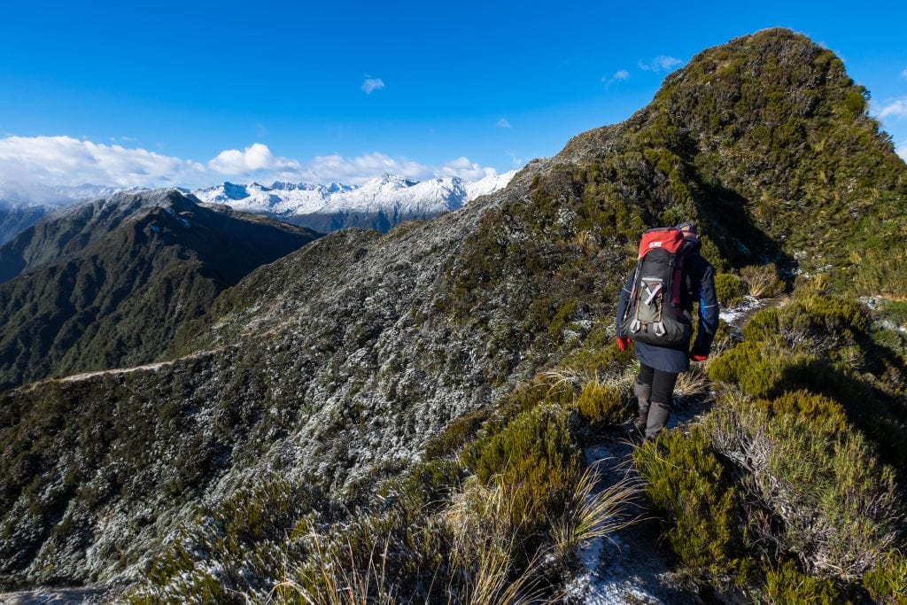
A traverse the Newton Range from Mt Brown to Newton Range Biv is a great and scenic option for fitter, more experienced types. The is rough and undulating and dips well into the alpine scrub zone just East of Mt Brown. There is a rough, unmarked trail through the scrubbier bits and there are quite a few ups and downs before a steep uphill section that leads to point 1240m. One more scrubby knoll needs traversing after this in order to reach open tussock. There are some nice tarns just before point 1336m and some interesting ultramafic rock outcrops on its eastern flank. The Range dips again after point 1336m and this is followed by a short steep climb over point 1240m after which the terrain flattens. Newton Biv is tucked against a tussock bank at the western edge of a flat peaty bench with tarns, GPS Ref: E1458873/ N5251148 (BV19 589 511). Snow stakes lead from the crest of the range over to where the Biv is sited. People are taking on average 7-10 hours to do this traverse according to the Biv's hutbook but it can be done in five by fit types. It is rumoured that DOC may be interested in cutting and maintaining the scrub sections of this route. Michal Klajban and Jan Kupka gave these bits a reasonably good trim in July '24.
Repairs needed.
It is likely that the burner will be removed at the end of its life given that we’ve stopped flying coal in and an absence of a natural fuel source at that altitude. A longer-term solution for the toilet needs to be sorted as we can’t go on digging holes around the place. These fill rapidly because of high use and the peaty nature of the surrounds and high water-table are not a hygienic option. A removable container seems the way to go, but the high costs of flying these in and out are beyond our budget. Lastly, that downpipe for the water tank needs to be properly affixed.
The track from Geologist Creek needs a bit of windthrow clearance at a the bottom end and a general trim in many places. Some corduroying and boardwalking on a few of the boggy bits would improve things.
Provisions on site
A kettle, a coal bucket and shovels, a poker, and broom. There is an aluminium ladder under the hut.
