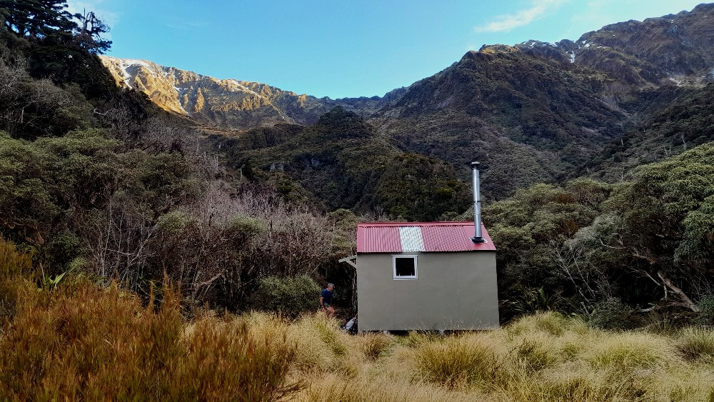
Mullins Hut
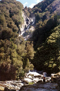 The Mullins waterfall
Maintenance Status
Mullins was designated as minimal maintenance by DOC in 2004. In February 2021 Richard Shields acquired some BCT funding and with DOC input carried out a total makeover on the Hut. This included the installation of a woodburner funded by the Permolat Trust. The access tracks to Mullins basin from the Toaroha valley and Diedrichs Range are being maintained by the Permolat group. Roger Woods and friends did some work on these in 2019 and a Jane Morris crew went back in September 2022 to improve tops access to and from the Hut.
Location
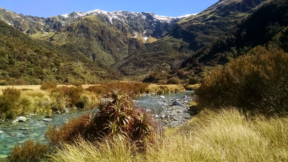
Toaroha catchment. GPS Ref: E1447037/ N5237863 (BV19 470 379). Map BV19. Altitude 870m. Mullins Hut is located at the top end of a large tussock flat in the hanging basin portion of Mullins Creek. It is a beautiful and tranquil spot that doesn't get a lot of traffic despite being accessible in a day from the Toaroha roadend. Sub-alpine forest cloaks the surrounding hillsides and there are views over to the Toaroha Range. Mullins Creek drops from the basin over a spectacular waterfall into the Toaroha River and whio can often be seen in its deep clear pools and rapids. A number of interesting tops journeys can be made in and out of Mullins Basin. Accounts of these can be found in the original NZFS hutbook that dates back 30 years in just about as many pages. Visits to the Hut have increased since it was profiled on the site, and the track opened up, but it's still relatively low use, around 20 visits a year.
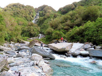 Fording the Toaroha at Mullins Creek in 2021
Access
Valley access to Mullins Hut requires a ford of the Toaroha River and as such is very weather dependent. The turnoff from the Top Toaroha track is at a routered wooden sign an hour or so up from Cedar Flat Hut and the river is crossed at this point. Historically, and at normal flows, the ford here has been relatively easy. Currently it is possible jump between some large flat boulders without getting wet feet wet however conditions will no doubt change again at some point. At last report there was also a reasonable ford a short distance upriver from Mullins Creek.
The Mullins track starts 20 metres up the TR of the small side-creek diagonally opposite from the turnoff sign (GPS Ref: E1447987/ 5239350N - BV19 479 392). It ascends a steep, narrow ridge to around 700m, then veers South and climb/ sidles in a series of steps across the faces to a dry creekbed. The track exits the creekbed on the TR and climbs onto a narrow ridge with pink pine and tūpare forest, then sidles around into a small creek catchment. A short wade up the stream leads to an exit on the TR that takes you up through scattered pink pine and alpine scrub onto a knoll overlooking the basin. Drop into Mullins Creek (entrance point GPS Ref: E1447331/ N5238245) and follow it, wading and fording where necessary, to the Hut. Allow around 3 hours to Mullins Hut from Cedar Flat, or 6-8 hours from the Toaroha roadend.
Type
Mullins was a standard NZFS 4-bunk S81 design built in 1960. It had its original chimney and fireplace removed very early in the piece. Richard's crew in 2021 included Armin Thuma, an architect who did the plan, and Grant Stevens who engineered it to adapt the traditional S81 plan to fit current building codes. The others in the group were Pam Stevens, Leeanne O'Brian, Geoff Joyce and Lawrie Mead. The original Hut was demolished down to the floor, the sub-floor strengthened, and the four corner piles replaced. A new frame was pre-built in DOC's Hokitika workshop by Miquel Dijkstra and choppered onto the base. The Hut was re-cladded, double-glazed windows were fitted, and a new roof and ridging added. The bunks were placed down one wall to make space for the woodburner. The flue was donated and knocked together by Duncan Hamilton of Dwan and Andrews in Hokitika. The new hut frame is strengthened to meet modern building codes and building paper provides much improved heat insulation. A woodshed was constructed with some of the original framing and cladding. A BCT funded toilet was erected in 2022 by Colin Morris and Roger Woods and Colin came back in with Jane's crew in 2002 to improve the drainage around the toilet. Water is from the Creek.
Condition
Mullins Hut is in mint condition currently although a leak was identified around the chimney by a recent party who were there during heavy rain. Water was dripping through it onto the wood burner.
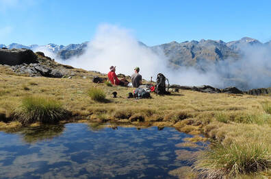 The Diedrich Range just above the old Jumble Top Biv site
Routes
There is a high-level route to and from Mullins basin over the Diedrichs Range that has become increasingly popular. Access to the tussock is up a small scrubby rib on the TL of the basin between two small side-creeks. It starts around E1446823 N5238000 (BV19 468 380) and was cut and marked in 2022. Waratahs lead from the top of the trail along the 1000m contour to a small creek. Cross this and head directly up the faces following the TL edge of the deep slot bounding the creek. At around 1400m the terrain flattens, and a beeline is made up and over a sharp-edged ridge into the top basin of Marcus Creek. Head from here up to the saddle between points 1780m and 1610m which is marked with a rock cairn and an iron. The flattened remains of the old Jumble Top Biv are visible a short distance below here.
Continue along the Range past points 1610m and 1612m to a small sharp peak at E1445735/ N5240927 (BV19 457 409) just before Jumble Top. A steep, exposed rocky section on its northern approach needs to be downclimbed with care. This bit can be bypassed on the Diedrichs Creek side by dropping down a steep scree and climbing back onto the Range further along via the scree's TR fork. The detour takes an extra 20 minutes and from here on travel is straightforward. There is a large tarn with good campsites on the SE side of Squall Peak and a track down to Cedar Flat can be picked up in patchy scrub on the Peak's NW spur at 1090m (GPS E1447197/ N5242071). Waratahs lead from the open tussock down to its top entrance. The track drops through the alpine scrub zone, then veers SE onto an open knoll at 950m. It drops steeply from here down through the sub-alpine and rata bands down to the Flat. The route was recut and marked in May and July 2020. A fit experienced party could probably do the trip over to Cedar Flat in 6-7 hours in good conditions. Add an hour or two for the reverse crossing.
Gerhardt Spur Biv can be accessed either by traversing Jumble Top and following Gerhard Spur down, or by dropping down a steep scree from the low point between points 1612 and 1610m, into the upper TL fork of Diedrichs Creek. Climb from the confluence of TR and TL fork more or less directly up the steep tussock faces onto Gerhardt Spur, connecting at around the 1300m contour. The Biv is visible from the top of the Range in fine conditions. Allow around 4-5 hours to reach Gerhardt from Mullins. Ice axes should be carried on these crossings in winter and spring.
The route to the upper TR basin of Mullins Creek is up the main branch to just before the start of a deep, slotted gorge. There is a marked exit at a small side-creek on the TR at E1446987/ N5237610 (BV19 470 376). A track goes up the side-creek to the scrub boundary in the upper basin. The top entrance is located at around E1447123/ N5237324 (BV19 471 373). A number of lines are possible from here through scattered scrub and tussock up onto the northern flanks of Mt Ross. Some of the lower tussock patches are populated with quite a high density of spaniards (ouch!). The tracked bit was cut and marked in 2022.
The upper TL branch of Mullins Creek is negotiable as far as the waterfall at E1446515/ N5237253 (BV19 465 373). Exit here up the small steep side-creek on the TL of the fall and climb to the 1600m mark on the SE ridge of the low peak of Mt. O'Connor. It is a very easy sidle from here across the basin under the middle and high peaks of O'Connor, then along a conspicuous bench to the low point NW of point 1718m.
Serpentine Hut in the Hokitika can be accessed by dropping off the Range at around E1445682/ N5236537 (BV19 457 365) and heading down the prominent SW running spur below. The top of this descent is very steep and may require ice axes in winter and spring. The spur was once tracked from the scrubline down to the Hut, and although it had an NZFS animal and vegetation survey line superimposed on it in the mid 1980's, it is now unfollowable. A few bits of permolat can still be found here and there, but it's essentially a pure bush-bash down to the river. The bottom portion of the track was cut from Serpentine Hut up to the 450m contour in 2017.
Another option is a traverse Mt. O'Connor and a descent of Serpentine Creek. The Creek's upper basin is easy travel with good campsites. Further down the going is rough with waterfalls that have to be skirted through steep bush. This route has been mentioned three times in the last 32 years in the Serpentine Hut books. Two of the accounts were neutral, the third and most recent (2011) highly scathing of its value as a route. It is around a half an hour's travel from the Creek up to the Hut. The tracked sections from Serpentine Creek to Serpentine Hut were recut in 2015.
An old NZFS track up onto Mt Robinson was recently reinstated by Permolat volunteers. It starts in Granite Creek at E1438903/ N5240302 and is cut and marked to the tussock at 1230m. From here to Mt Robinson the ridge is rough and undulating with quite a few steep little aretes, and some exposed bits. The notch between Mt Robinson and Pt. 1366m has a steep vertical pitch leading down on which hand holds are minimal, and a rope is recommended. From here it is easy travel along the broad, open ridge leading up to Mt O'Connor. A large tarn at the old Knobby Ridge Biv site near Pt. 1366m provides a good camping spot. This would make for a good three-day tops circuit for the more experienced.
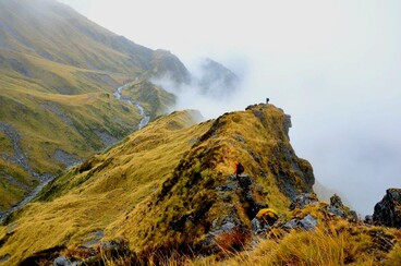 Looking down into Darby Creek basin from the TR on the Frisco crossing
Frisco Hut in the Hokitika can be accessed down Mt. Ross's broad SE face as far as a prominent bench at the 1500m contour. An rocky gut provides easy access from the SW end of the bench (around E1447618/ N5234888 (BV19 476 348)) down into the Darby Creek basin. Head up Darby Creek for a bit, then up onto point 1510m. Drop down the SW spur of this peak to an obvious tussock bench with tarns just above the scrubline. Waratahs and the odd bit of permolat lead from the SW corner of this bench down to the top the scrub faces above the Hut (E1446195/ N5234400 (BV19 462 344)). The toilet and part of the roof should be visible from here. Follow the markers off the edge of the bench down the faces into narrow gut that leads through olearia forest to intersect the Darby Creek track 50m East of the Hut. The tracked portion was recut and marked in March 2018. Allow 5-7 hours for the crossing from Mullins to Frisco.
Darby Creek basin can also be accessed over the col between Mt. Ross and point 1718m on the Diedrichs Range. The faces on the Darby Creek side of the col are eroding and exposed, with some vertical sections that are not visible from above. Your best bet is down a scree that drops diagonally from the lowest point in the Range into the Creek. Climb from the Creek up onto the ridge of the TR of the basin and follow this down to point 1510m. The route from here to Frisco Hut is the same as the Mt. Ross route.
Top Toaroha Hut can be accessed from Mullins Hut via the prominent spur that runs in a dog-leg due North from Mt. Ross to point 1251m. Drop from the flat bench above the 1400m contour of this spur into the North branch of the large unnamed side-creek draining the eastern faces of Mt. Ross. The tussock faces at the top of the descent are steep, but the creek provides nice, albeit steep rocky staircase, with a couple of small waterfalls near the bottom that can be skirted without too much difficulty. There is an excellent two-tier rock bivvy on the TL of the main creek, 100m upstream from where the Top Toaroha track crosses it. The remains of the old Top Toaroha Hut can be found in olearia scrub just below the rock biv.
Toaroha Saddle Biv can accessed over Mt Ross. It is a long gentle descent along the crest of the Range to the Saddle. Allow 4-5 hours for the crossing.
Repairs Needed
If someone's up there during fine weather and can put some sealant around the flue, that would be appreciated. The axe handle has broken and a shortened one fashioned from a broken slasher handle. A new axe needs to be taken in.
Provisions on Site
An axe, a saw, a billy, a small camp oven, a slasher head, two can openers, an eggbeater, a shovel, a broom, an aluminium bucket, a plastic bucket, an aluminium basin, a dustpan and brush, a spare slasher handle, a sealant gun, a tube of sealant, a hammer, 4 paint brushes, a couple of rollers, 2 new roller sleeves, and an aluminium ladder. There is a small quantity of nails and permolat on site. Under the hut there are some lengths of 125x125 timber for piles and a couple of tanalised posts.
