Top olderog biv
 Looking along the McArthur Range to Mt Olsen from Mt Kerr
Maintenance Status
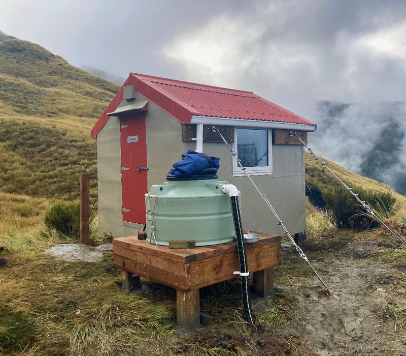
Top Olderog is designated as minimal maintenance by DOC back in 2004. It was one of the last of the high stud bivs built by the NZFS in the early 1970's and was still structurally sound and weatherproof when DOC did their review back then. Some minimal maintenance, repair work, and painting did take place over the years and in March 2023 BCT used some of the last of the Kaimahi for Nature funding to do a major overhaul likely. This should leave the biv in good shape for many decades to come. One of the key access routes to the Biv is by way of an old NZFS track onto Mt Kerr and the McArthur Range from the Wainihinihi hydro road. This is not officially maintained but has been kept open by Permolat volunteers and is reasonably good nick.
Location
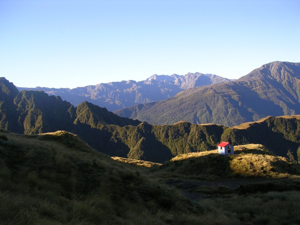
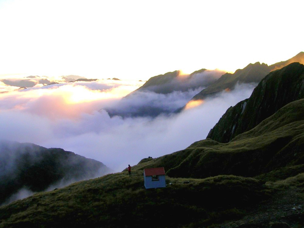
Arahura catchment. Map BV19. Grid Ref: E1464308/ N5257604 (BV19 643 576). Altitude 1250m. Top Olderog Biv is remote in the true sense, set on a tussock bench high above Olderog Creek. Prior to being profiled on this site the Biv was getting one visit every 3-5 years. On my first visit there in 2004 I found the remnants of an old NZFS food drop in the storage drum. There was some petrified butter wrapped in 1973 editions of the Hokitika Guardian and a packet Red Rose tea that had turned powdery over the decades. It didn't make a particularly satisfying brew, but then Red Rose was never that great, even when fresh. The visitation rate to the Biv increased to about 3-7 visits per year after it was profiled on Remote Huts, with five recorded in 2022. It is unlikely that you would encounter anyone if you were heading up there. The views from Top Olderog are stunning, the sunsets beautiful, and the stillness and sense of isolation palpable. A number of reasonably challenging tops routes are possible from the Biv to other remote huts in the area.
Access
The most direct access to Top Olderog is via a track up onto Mt Kerr from the hydro road in the Big Wainihinihi River, which is a continuation of the Milltown Road in the Arahura Valley. There are a number of locked gates on it, the first around 2km from the Arahura bridge. The locked portion is around 7.5km and can be cycled 35 minutes from the Arahura end, or 45 minutes (9.5km) along the West Coast Cycleway from Dillmanstown.
The track up onto Mt Kerr starts at the unnamed creek on the big bend on the Hydro Road (E1461160/ N5260130 (BV19 612 601)). There is a routered sigh at its entrance is on the TL of the creek. The track climbs steeply up onto the ridge on the TL of the creek and follows it all the way to the tussock. It veers SW here and continues up through a band of alpine scrub to the top entrance at around 1150m. It is a mix of open tops and patchy scrub to the old trig site at point 1278m. There is a short dip then a steep section of ridge up onto Mt Kerr.
The crest of McArthur Range is followed from Mt Kerr until directly above the Biv. There are numerous ups and downs and some steepish scrambles around small rock outcrops with plenty of vegetation to hold onto. Most of the traverse is reasonably easy going. The Biv is sited around 100 vertical metres down the Olderog side and is visible from the top in clear conditions. The drop off is from a dip in the Range at a small tarn at E1464406/ N5257814 and is marked with a waratah. Two more stakes lead down towards the Biv. Allow 6-8 hours travel from the Road to the Biv or 7-9 if you have to walk from the locked gate.
Type
Top Olderog Biv was the first of a new generation B142 high-stud design, built in 1971 by Tony Newton and Mario Geremia of the Hokitika NZFS. It has two sleeping platforms with mattresses, and the original had a louvre window on each side. It was built with treated timber, was lined, and was very cosy and light inside. Louvres weren't the best option for high altitude weather however, and the South window blew out in the late 1990's or early 2000's, leaving the Biv open to the elements for a number of years. The door was hung to open inwards and couldn't be flashed at the bottom in a way that would stop the rain driving in under the door during the frequent storms. The original tie-downs worked fine and held the Biv down for 50 years in all kinds of extreme alpine weather. They comprised a continuous steel wire at each end that ran over the roof beneath the iron. The wires were held at ground level by crossed waratahs driven firmly into the layered schist substrate. Two small tarns next to the Biv provided water. There is no toilet.
Condition
Top Olderog Biv was repainted by DOC in 2008. Some buckled interior wall lining and the door were replaced, new louvres fitted in the South window, and the tie-downs tightened. The 2023 BCT overhaul was comprehensive and carried out by Ollie Clifton and Al Ritchie with myself and Liam Hall as hammer hands. The roof was replaced with lead-free fittings, the louvre windows replaced with single pane ones, and a small water tank installed. The door was rehung so that it opens outwards and is flashed properly at the bottom. The tie-downs were replaced with a new set that I consider ridiculously over-engineered for such a tiny structure. This is the DOC compliance stuff that drives a lot of us mad. The new lot needed four deadmen placed 750mm deep as anchors with the attaching cables and rods fastened to large wooden plates each about a third of the length of the biv on both inner and outer walls. It took us two days to dig through the flaky layered schist to get the holes for the deadmen to the required depth and Al the best part of a day to instal the plates. The body of the Biv obviously isn't going anywhere, but the irony is that the roof is now no longer held down by anything substantial. The hut walls and door were repainted. The original silver pine piles are all good with plenty of clearance and airflow under the Biv. Additional fasteners were placed between the piles and sub-floor. One of the windows has a cracked inner pane which wasn't noticed when transporting up there and was possibly caused by altitude change.
Routes
Lower Olderog Biv can be accessed by climbing onto the crest of the McArthur Range and following it along to the McArthur Crags. Drop down the SE spur of the Crags skirting several pointy bits lower down on their southern sides. Climb back to the top of the last point and drop from it onto a flat area with three tarns overlooking the northern end of the ultramafic bench. Drop from the northern edge of this bench (E1461531/ N5256404) down a scrubby face to a second bench with cairns. Drop from the eastern end of this and follow a cut and marked trail across a scrubby gully to a saddle (E1461720/ N5256230) between a prominent ultramafic rock outcrop and the main hillside. Follow the cairns in a SW direction down a jumbled rocky gut towards the Biv clearing. The Biv itself is visible in fine conditions from the top of the ultramafic band. Allow 4-6 hours in good conditions for the journey from Biv to Biv.
Although it appears benign from a distance, the section of the McArthur Range from Top Olderog Biv to Mt Olson is not recommended as a route. There are a number of vertical pitches and one very exposed sidle with minimal handholds. To access the Tara Tama Range or Newton Creek Hut via the tops you need to drop into the head of Olderog Creek. The route is down the second side-creek upriver of the Biv which can be reached by sidling across the tussock faces along the 1250m contour. Travel up Olderog Creek is OK initially with the odd bit of a scramble to get around some small cascades. Further up things open out and it becomes quite idyllic and picturesque, as well as easy travel. A steep gut in the head of the creek provides access onto the col between Mt Olson and point 1566m.
Traverse Mt Olson from the col and drop down its SE flank towards a tussock bench with some shallow tarns at 1100m (E1466942/ N 5256148) pretty much directly above Newton Creek Hut. There are some good deer trails through the alpine scrub and the forest further down is reasonably open. Allow around five hours for the journey from Top Olderog Biv to Newton Hut.
Access into the upper Wainihinihi Basin from the crest of the McArthur Range is via the first side-creek downriver from Magnesite Creek. The drop-off is at a small saddle at E1463926/ N5257969 (BV19 639 580) and the steep gut below it leads down into the creek. The creek swings North lower down, passing through a band of alpine scrub which is less thick on the TL. Once in the Wainihinihi It is easy travel up the river flats with plenty of good campsites up to where the valley closes in. To access the Tara Tama Range continue upstream into a small canyon which is exited up a side-creek that comes in on the TL at E1465523/ N5258487 (BV19 655 585). Clamber up a series of smooth rock chutes for a couple of hundred metres to where the creek opens out and exit onto the tussock terrace on the TR of the canyon. Head NE from here across a small side-creek and onto the prominent ridge that connects with the Tara Tama Range just SW of point 1572m.
Scottys Biv can be accessed by traversing the Tara Tama Range around the head of Newton Creek basin and down to Scottys Saddle. A 20-minute amble down a series of sloping benches and tussock faces from a point just NE of the Saddle will get you down to the Biv, which has a high-viz red roof.
Griffin Creek Hut is accessed from the unnamed saddle 200m South of Scottys Saddle. A cairn on top of a large boulder marks the drop-off down an old scree into the creek catchment below, which is dry in its uppermost portion. Further down there is a waterfall that has short section of track through the alpine scrub on its TR. A steep section with large boulders and small cataracts follows and requires a reasonable amount of agility and dexterity to negotiate. Further down the creek flattens and the going becomes easier. The Rocky Saddle track crosses the creek 400m above its confluence with the Giffin and intersects with the Griffin Creek track further down. Follow the main valley track upriver across the montane terraces for around 15 minutes to the Hut. Allow a full day and good conditions for the Griffin and Scottys routes.
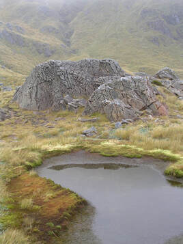 Tarn and ultramafic outcrop in Cold Creek headwaters: Andrew Buglass 2012
Griffin Creek Hut can also be accessed via the upper Wainihinihi and the Griffin Range. Cold Creek provides a reasonable route up out of the Wainihinihi basin. The lower section of the Creek has a series of slippery little cataracts, which can either be scrambled up, or skirted through the scrub on the TR. Further up the Creek forks and either branch will get you onto the tops. There are some benches with small tarns and picturesque ultramafic rock outcrops on the TR of the TR fork. Another option is via a spur on the TL of Cold Creek which is mostly open tussock. The remnants of a pre-WWI serpentine mine and cableway are still visible on the NE side of Mt Griffin. The vertical drop-offs on the Wainihinihi side of the ridge heading down towards Wilson Knob are pretty awesome. The track down through the alpine scrub to the Griffin Creek turn-off starts a couple of hundred metres NE of point 1126m at GPS Ref: E1467135/ N5261729. It was recut by Permolat volunteers in January 2021. Allow a full day and good conditions for the Olderog - Griffin crossing.
It is possible to get from Top Olderog to Lower Olderog Biv down Olderog Creek itself, although it's certainly longer, and probably more difficult. There are two gorges to get through before exiting the creek at the base of the ultramafic rock zone. A rock and scrub scramble is necessary to gain access to the bench above Lower Olderog Biv. My one attempt to find a decent route down from the top of the bench into the creek wasn't a success. It's probably easier to locate a good line when coming up from below. Allow seven hours for this route, in contrast to the tops traverse which takes 4-5.
Repairs needed
None hopefully.
Provisions on site
One billy, one small collapsible shovel, an aluminium bucket, a hand brush and shovel, a small quantity of small flathead nails and permolat. There is an old door, a makeshift ladder, a few bits of tongue and groove and 4x2, and a coil of No. 8 wire under the Biv. Eigill left a hammer, a screwdriver, some rasps, and plenty of 50mm screws. The screws and screwdriver will come in handy if the nails holding the iron cladding start lifting. There is a 10L container Weathershield lichen, 2 x 4L stain and mould blocker, white water-based primer, 4L Aquanamel semi-gloss true red (for door), and ½ of a 4L tin of metal primer - white.
